Friday, May 12, 2017

Mesa Verde from Park Point

Looking south from Park Point, Mesa Verde National Park, Colorado.
Early May, and the spring season is well along. Not far from the Memorial Day weekend start to the real crush of visitors. A great time to explore the park before it gets hot and crowded.

I had been working at the Museum and was driving home. The past few days had been wet and cold. The warm weather residents that were visiting were miserable and complaining a bit. Hey, springtime in the Rockies....

But the cold front passed, and cumulus clouds were accenting the blue sky once again. As I drove north from the Museum on Chapin Mesa, I stopped at Park Point, highest knob of landscape within the park. It has 360 degree views all around.

 Photo location: Mesa Verde National Park, southwest Colorado.

© Copyright 2017 Stephen J. Krieg

Tuesday, May 9, 2017

The Great Sage Plain Greens Up

Winter wheat fields and Abajo Mountains, Dove Creek, Colorado
Going home, early May. Dove Creek, southwest Colorado.

Actually I had come up from the lower Dolores River at Slick Rock, enjoying the swollen river and the boaters floating down to their take-out landing.

Then I drove up over the landscape, over high mesas, and came back out to Highway 491. What a view. The fields of winter wheat so green in the cold wet springtime soil. The Abajo Mountains in the distance, in Utah 20 miles west. The wet skies dancing about, teasing a bit more rain.

Photo location: Dove Creek, Colorado.

See more of my photography at www.NaturalMoment.com.

© Copyright 2017 Stephen J. Krieg

Tuesday, May 2, 2017

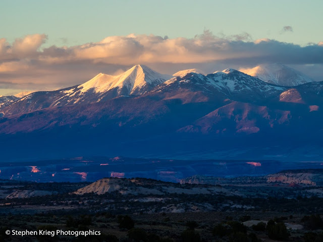
La Sal Mountains Springtime Sunset

La Sal Mountains at sunset from near the Bears Ears National Monument boundary, San Juan County.
Late April in southeast Utah and the Four Corners country, and the weather was moody. I like the variety that it provides.

Driving west out of Monticello toward the Abajo Mountains, the road veers northward toward Utah 211, the highway into the Needles District of Canyonlands National Park. But before you get anywhere near that portion of the park, you cross the invisible boundary (since it's so new) of part of the eastern boundary of Bears Ears National Monument.

That evening, my eye was not on going into the Needles, but on staying high to watch how the sunset light would play out onto the La Sal Mountains to the northeast, near Moab.

As the sun slid below the western horizon, the low angle of its light lit up the still snowy peaks of the La Sals. Warmer, then a bit pink, too.
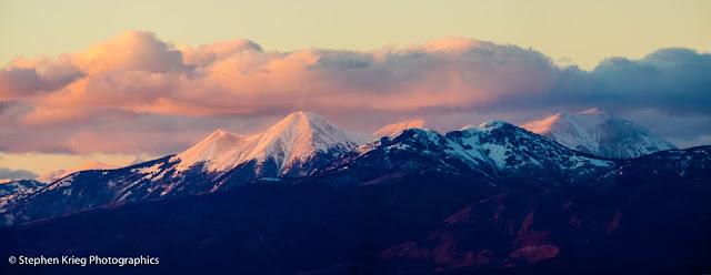
La Sal Mountains peaks at sunset color.
Zooming in with a longer lens, I made a series of overlapping shots from which to make a super high resolution panoramic image in Adobe Lightroom.

Soon the colors had faded, and it was time to drive home in the twilight. 

See more of my photography at www.NaturalMoment.com.

© Copyright 2017 Stephen J. Krieg