Tuesday, December 30, 2014

Christmas Across Southern Utah

Bryce Canyon National Park, Utah, Christmas morning.
My Christmas day started at Bryce Canyon National Park. It had been a while since I'd been back up there (over 8,000 feet in elevation) and I'd headed into a snow storm. Literally. I'd gone there when I saw a storm was coming in, and met it. It's the Mountain Man Way. 

But I had to get home that day, over 250 miles to the east. So I couldn't linger too long at Bryce, unless I wanted to stay a second night and drive back very early in the dark. I didn't.

Near Tropic, Utah. Love the cliffs and canyon country.
So it was down to Tropic (Is it really that warm? Not today). Beautiful country with the cliffs around the valley. This is the upper reach of the immense Paria River watershed, which only ends where it empties into the Colorado River at Lees Ferry, Arizona. A long, long, long way downstream.
Paria River at Tropic, Utah.
I love the small towns that dot southern Utah. And there aren't many of them. To this day it's still wild, rugged country. The locals are very friendly, which I've noticed is the norm when the people are few and they depend on each other. And outsiders, tourists, which are a big part of the economy around here these days. Spend some money enjoying our beautiful area; we love showing it off if you'll respect it, too. 

Highway 12 cuts through the cliffs.
I sure respect it. I enjoy rural highways with almost no other cars on them. It makes it so much easier to pull off on a second's notice to take yet another photo. 

Which I did a lot of on this trip. It was snowing a lot, but the road was fine, mostly. Nothing my trusty RAV4 couldn't handle without sliding. 

Approaching Henrieville, Utah.
Then on to Escalante. I like that town. Another vow to visit again, who knows what might happen? Just outside town was a very nice tribute to the Hole In The Rock pioneers of 1879-1880. Yes, in December and January, too. A feat that amazes us to this day. 

Escalante, Utah outskirts. The clouds were even opening up.
So it was on to Boulder, Utah. Boulder Town it says on the map. Maybe to distinguish it from the much more famous City of Boulder perched on the Front Range in Colorado. At any rate, this Boulder sits at the head of the Burr Trail, an incredible road that winds down through the Waterpocket Fold, which is a cool name in itself. 

Grand Staircase-Escalante National Monument from Highway 12 overlook, west of Boulder, Utah.
Besides, Utah's Boulder sits near the Circle Cliffs, amazing sandstone cliffs that...well, aren't straight. They have joints in their slickrock faces that make plates in the rock that I suspect were the inspiration for The Thing's body in The Fantastic Four. Oh, go ahead and laugh. Then check out my photos. Yeah. "It's clobberin' time!".

Circle Cliffs in snow, Boulder, Utah.
Looking down the upper Burr Trail.
I really wanted to camp there at the upper end of the Burr Trail, with the Circle Cliffs. So beautiful, especially with the new coating of snow, like marshmallow creme or confectioner's sugar wiped across them. Next time, I vowed. May there always be a next time. Some of them do come true. 

Highway 12 above Boulder goes up and over a shoulder of the Aquarius Plateau, also nicknamed Boulder Mountain. Whatever. It does go high into aspen forest, with splendid views to the south of the vast lands around here. Out there. The kind of view that leaves you wanting to put everything into perspective. Wanting to visit it all. Knowing you never will explore it all, but the effort will be its own reward. 

Down off Boulder Mountain. Time to cross the upper end of Capitol Reef National Park. And by now it was late afternoon on a late December day. Meaning a short winter day, sunset coming soon. Talk about burning daylight. Got to get in all that I can in such a short time, because then it will just be a drive in the dark. 

Stay tuned.
Saturday, December 13, 2014

December Weather Finally Arrives in Canyon Country

[Outside the snowy Visitor Center, Natural Bridges National Monument, Utah.]
I was up this morning well before dawn, as usual. Soon after I could hear the rain falling on the roof: the promised storm front had moved inland from California all the way to southeast Utah. 

But soon after...no sound. It was getting light, so I looked outside and saw snow falling. The rain had become the white stuff that quickly. Falling straight down, no wind. A wet, heavy, beautiful snowfall.

Russ and I opened the Visitor Center. Old Glory raised on the flagpole, cash registers open for business, visitor statistics logged on the clipboards. Lights turned on inside. Sidewalk shoveled. Soothing instrumental music playing. 

Nobody came. Not right away. That's all right, we're out in the middle of nowhere and it takes some time to get here. Meanwhile our erstwhile maintenance crew was running the snowplow truck, clearing the road in from Highway 95. 

Eventually the first visitor came. Then a couple more. Such soft glowing snow light outside, coming in through our floor to ceiling windows. Wet snow sticking on every piece of vegetation outside. 

I walked down to the house to eat lunch. The clouds were starting to clear. I had to get out there, had to do a rove, even though there were only two of us manning the Visitor Center. After all, we weren't exactly being swamped by visitors. Though the few that came enjoyed it: welcoming, peaceful, no lines of tourists. 

[Canyonlands Natural History Association Book Store, Natural Bridges Visitor Center, snowy day].
 So out the loop drive, Bridge View Drive officially, I drove. Stopped to take photos in the bright light, the reflections on the wet slickrock sandstone, on the surfaces of the water pockets. 

On the trail down to Kachina Bridge I met up with two young ladies that I'd talked to in the Visitor Center. "Did you come to check on us?" Well, yes. Maybe. I knew you'd be fine, the road is fine and it's above freezing so there will be no ice on the trails. Until morning. I came to check on the Park. On this fantastic place, the only place in the world with three mighty stone bridges within a few miles of each other. With fresh snow on the mesa rim. That's what I came to check on. 

[Walkway to Sipapu Bridge viewpoint, some blue sky already].
Meanwhile, back at the Visitor Center Russ and I wrapped up the day. I tallied up the sales. The book store proceeds go into the Park programs, not into some corporation's balance sheet. I gently point that out to visitors whenever I can, because they like knowing that. Give back to the park while buying something you like. It's synergy.

But the day was not quite done. Still on the menu: sunset. 

I drove out to the big curve I've dubbed Sunset Curve. Why? Because it's a big curve in the road. Ok, ok, but because it has a nice turnout spot which faces west for the sunset. Awesome view, no power lines, no nothing except clean air, high desert mesa, buttes and sky. 

As sunset colors go, it was muted. Which only served to not distract me from the foreground, the fresh snow on the sandstone boulders, the high desert mesa. I loved the soft light, I walked around with my camera and tripod all around.

[Snowy sandstone boulders at sunset].
If it gets much better than this, I don't want to know about it. I'm not sure I could take it. Though I'd try.

---------

Photo location: Natural Bridges National Monument, San Juan County, southeast Utah. 

Click on each image for a much larger version.


Prints and photo products are available on my Fine Art America sales website:
http://stephen-krieg.pixels.com/


© 2014 Stephen J. Krieg

Monday, December 8, 2014

Moon Leaving, Sun Arriving, Natural Bridges

Moonset and Earth's Shadow at Dawn.
I got skunked this month as far as my monthly moonrise shots of the Full Moon. That's why I try to be ready each month, because you only get twelve a year, and some of them will be snuffed out by unfavorable weather. Or you need to be doing something else. That sort of thing.

The evening of the December Full Moon had too many clouds on the eastern horizon where I was in southeast Utah's high desert canyon country. By the time the moon appeared through the thin clouds it was hazy, wan. Blah.

My backup plan for moon landscapes is the morning after Full Moon: moonset. Most photographers overlook that time, when being out at dawn allows you to position the setting moon in a landscape facing west instead of east. 

I was at Natural Bridges National Monument. Being December, I had the Bridge View loop drive to myself that early in the day. Winding along the rim of White Canyon, I stopped for a look down at Sipapu Bridge. The stone bridge itself was too dark for a good photo that early, but I noticed the small potholes in the sandstone bedrock that had water still in them from the last rain. I made a composition with one reflecting the moon. 
Moon reflection in sandstone pothole at dawn.


Then further along the loop drive, I liked how the dawn colors were shaping up in advance of sunrise. The Earth's shadow and the blue to pink gradations of the Venus Belt made for another moonset shot. 

Finally I was at Owachomo Bridge, the oldest of the three stream carved bridges in the park. I was hoping to find some angle to get the bridge and the moon together in a shot. Owachomo is the best candidate for that, because it's much more out in the open than the other two bridges, Sipapu and Kachina. 

Moon setting over Red House Cliffs.
 But I couldn't find the angle necessary. So I enjoyed being down underneath the bridge once again ("Owachomo" is Navajo for "under the horse's belly"). If it was a horse's belly, it was one long, skinny horse. Majestic in its own way. A slender bridge compared to the other two, this one is the oldest, the most eroded and so the thinnest. It will fall the soonest. Whenever that might be.

But not this morning. I continued down slope from the bridge, to the stone lip along the creek still slowly carving Armstrong Canyon. 

From down there I could not yet see the sunrise itself. But it was lighting up the south side of Owachomo's sandstone span. With clear blue sky behind. Nice, very nice. 
Owachomo Bridge at Sunrise, December.
Photo location: Natural Bridges National Monument, San Juan County, southeast Utah. Click on any photo to enjoy a much larger version.

Prints and photo products are available on my Fine Art America sales website:
http://stephen-krieg.pixels.com/


© 2014 Stephen J. Kriewg

Saturday, November 22, 2014

Cedar Mesa Sunset Skies

[Photo: Cedar Mesa sunset panorama, southeast Utah. Click on image for larger version].
The clouds built throughout the day. Not ominously, but maybe more toward the slight chance of mixed rain and snow forecast for the night. 

I've become a weather forecast pessimist. In that the precipitation, be it rain or snow, won't materialize where I am. The weather service seems to over-forecast, to cover their butts, so we dear citizens aren't caught unaware of a bad storm. Ok, so we're prepared, usually for nothing.

As evening approached I, as usual, gauged the chances for a fiery sunset. The clouds have to be in the right position. All afternoon I'd written off the prospects as being too overcast. But at 4:45 I saw a clear slot on the western horizon just north of Moss Back Butte, where the sun would set. Hmm. If those clouds stay like that, it could really light up.

My stomach got the better of me. Should I go to one of my favorite sunset spots and wait, wait, hungrily? I did not. Then while I was cooking a pasta meal, furtively glancing out the picture window, the conditions fell right into place. 

Turn off the stove and dash out there. Fortunately I have a backup sunset spot nearby, a minute's walk away. I used it. Made several overlapping images, then -- after supper, of course -- merged them into a huge high resolution panorama master file. 

I should have been at my best sunset spot, though. With a bag of chips to tide me over. Next time, next time.
[Photo: Sunset afterglow, Natural Bridges, Utah].
---------

Photo location: Natural Bridges National Monument, San Juan County, Utah. Olympus E-PL5, developed in Adobe Photoshop and Lightroom 5.

Sunday, November 9, 2014

Mighty Sipapu Bridge, October Afternoon

Sipapu Bridge, Natural Bridges National Monument, Utah
[Photo: Sipapu Bridge, October Afternoon].
A late October afternoon at Natural Bridges National Monument in southeast Utah. I call this park a hidden gem within the National Park System. First time visitors often agree, vowing to come back and spend more time next time. 

Why? At first glance it might seem somewhat unspectacular. No massive canyons or mountain peaks nearby. Some distinctive buttes. Mostly flat high desert terrain, with Pinyon pine and Utah juniper for well spaced forest cover. It only takes an hour to stop in at the friendly, uncrowded Visitor Center, watch the ten minute video, and drive the one-way paved loop drive to the overlooks. Done, on to the next National Park in amazing southeast Utah ("Life Elevated"). 

What's more, you can't see the three stone bridges very well from the overlooks. You look down at their tops. What gives? Well, you have to hike down into the canyons from the overlooks to really get it, to see them, to get great photos. The first two bridges, Sipapu and Kachina, take an hour each round trip, dropping down 500 feet vertically for Sipapu and 400 feet for Kachina, in just a half mile. That's steep. But quick. And they are beautiful, interesting hikes down. Switchbacks across slickrock (i.e., bare) sandstone cliff faces, steps cut into the rock, rock steps built up onto the stone, even a few short ladders to climb down (bolted safely to the cliff, of course). So they are very fun, very photogenic along the way.

Then you have to climb back up to your car. That's the strenuous part. Great exercise. If you're not acclimated to 6,500 feet in elevation, maybe very strenuous. Just not for the out of shape. But well worth it. 

As an alternative to down-and-up hikes to each bridge, loop hikes make it even more fun, getting to see the canyons (White Canyon and Armstrong Canyon) along their stream courses. You can do two of the bridges, via the north loop and south loop, or all three via the total loop.

Natural Bridges, the hidden gem. Spend an hour, a day, a week. Well worth it.

---------

Photo location: Sipapu Bridge (the largest and middle aged of the three in the park), Natural Bridges National Monument (first unit in the National Park System in Utah, declared a National Monument by President Theodore Roosevelt, in 1908), San Juan County, southeast Utah. Thirty five miles west of Blanding, UT.

Wednesday, October 29, 2014

Aspen Forest, Abajo Mountains, Sunrise

Up into the Abajo Mountains on the Manti-La Sal National Forest west of Monticello, Utah. Until now I'd only been able to admire this small mountain range from the edges, from afar. Now I had the time to start exploring them.

Quickly I was up into thick, tall, lovely aspen stands amidst the fir and spruce. The sun came up and lit the aspen trunks a pale gold. The towering shape of Abajo Peak made for a great background against the clear blue morning sky.

Photo Location: Manti-La Sal National Forest, San Juan County, southeast Utah.

Wednesday, October 22, 2014

Owachomo Bridge, From Below

[Photo: Owachomo Bridge, Natural Bridges National Monument, Utah].
Evening light at Natural Bridges National Monument, a small and very isolated corner of the National Park system. The hike down to this bridge, Owachomo Bridge, from the overlook loop road is very much the easiest of the three bridges in the park. And well worth it, because from below the rim of the canyons you get an infinitely better feel for the place.

Natural Bridges is easy to visit, and beautiful, with a lovely Visitor Center and a nine mile paved loop drive to the overlooks. It's in the middle of nowhere in southeast Utah, accessible by good highways with very light traffic. Just make sure you have plenty of gas and snacks. The air is clear and the night skies are amazing. There are no accommodations at or near the park, just a small campground and millions of acres of surrounding BLM and National Forest land for "dispersed camping". The nearest accommodations are in Blanding, about 40 miles to the east.

Saturday, October 11, 2014

Kanab Creek Wilderness, From Gunsight Point

[Photo: Snake Gulch on the left, Slide Canyon on the right, from Gunsight Point].
I finally drove out to Gunsight Point. I used to pass the turnoff on my way back and forth to elsewhere, each time saying to myself, "I've gotta go out there sometime and see what's there". 

The other day, as I passed it one more time, maybe one last time, I said, "Why not now?" Turned around and drove out the lonely BLM road. Today's the day.

At Gunsight Point I was surprised to see a helicopter. And crew to refuel it. So I asked what was going on. It was some wildlife biologists from the Arizona Game and Fish Department, doing aerial surveys of the bighorn sheep population in the canyons. "It's usually not so crowded out here," joked the lead biologist. True, I only saw one other car out there all day.

So, with three days off, I was glad to get out my camp chair, cooler, and camera and stretch out right on the rim of Kanab Creek Wilderness, on the Arizona Strip just south of Fredonia and the Utah State Line.


Sunday, September 21, 2014

Aspen Colors Closeup, Kaibab Plateau

  
[Photo: Aspen leaves, Kaibab National Forest, Arizona].


Autumn continues its slow but gradual progression up on the Kaibab Plateau on the northern Arizona Strip. Warm, shortening days along with cool nights still free of frost or an early snow are doing the job. Those conditions tell the aspen trees that there is no hurry to drop leaves. A gradual lessening of the green chlorophyll in their leaves reveals the other colors, especially yellow and gold, sometimes orange and red.

I was slowly cruising through the Kaibab National Forest between Jacob Lake and the North Rim of Grand Canyon, looking for the earliest colors. In the morning light I was able to get close to some lower branches with outstanding colors. The Still green foliage of the other trees behind it served as a rich background to contrast with, along with the clear blue sky.

Autumn gold, blue skies, warm sunlight, chilly nights. The best time of year.

Photo location: Kaibab National Forest, North Kaibab District, near DeMotte Park, Arizona. 

Sunday, August 17, 2014

Kaibab Forest Sunset

Sunset, Warm Fire burn, Kaibab National Forest, Arizona
August on the Kaibab Plateau, the "mountain lying down" to the Paiute Indians. The high (7,000-9,000) gently curved mountain with no peaks, raised up from the Marble Platform down below by the Earth's ever flexing forces.

Near the edge of the now eight year old burn left by 1996's Warm Fire (an ironic name for such a massive, hot fire, almost 60,000 acres) I took advantage of the opening in the forest to admire some sunset cloud colors. The day had been one of summer monsoon thundershower activity, but all around me rather than on me. The leftover thunderhead and cumulus clouds reflected the setting sun, and the Ponderosa pine trees provided some nice silhouette shapes.

Photo location: North Kaibab Ranger District, Kaibab National Forest, between Jacob Lake and North Rim of Grand Canyon, Coconino County, Arizona. 

Wednesday, July 16, 2014

Kaibab Plateau: Sunset Rain Colors, Rainbow Rim

[Photo: Sunset rain colors, Rainbow Rim, northern Arizona.]
A summer evening on the Rainbow Rim in northern Arizona. July: the summer monsoon season has begun. Moisture from Baja California flows north into Arizona, and the clouds build quickly in the mornings. Most mornings. 

Thunder in the afternoon. Lightning around, so keep a wary eye out. Make sure you're not too exposed if it gets within about ten miles of you. If you see lightning in the distance but can't hear the associated thunder, it's too far away to be of concern.

Rain blesses the high desert, and the high lush forests of the Kaibab Plateau. At sunset time, a gap in the clouds on the western horizon arrives right on time. The rain and clouds provide the reflector screen, the veil, for the setting sun, warming the colors to yellow, pink, purple against the blue light in the shadows. 

The Rainbow Rim sits on the edge of two giant chunks of federal land: the North Rim of Grand Canyon National Park, and the North Kaibab Ranger District of the Kaibab National Forest. On the cusp. Looking down into Grand Canyon north of the Colorado River. 

Photo location: Rainbow Rim, Kaibab National Forest and Grand Canyon National Park, Arizona. Copyright © 2014 Stephen J. Krieg.

Thursday, June 5, 2014

Wotan's Throne at Sunset, Grand Canyon

Sunset at the North Rim of Grand Canyon means being at Cape Royal if at all possible.

[Photo: Wotan's Throne at Sunset, Grand Canyon North Rim].

It's the southern tip of the Walhalla Plateau, the end of the scenic drive at the North Rim. It's the climax of the show: the most dramatic view of all (which is saying something!), looking out at the massive sky butte named Wotan's Throne.

At sunset time, unless the clouds on the western horizon cut it off, the low angle of the sun's rays reflect off the cliffs, making them glow yellow to gold.

Copyright © Stephen J. Krieg | Stephen Krieg Photography

Sunday, May 11, 2014

Vermilion Cliffs Golden Sunset Shower

Sunset through rain shower, Vermilion Cliffs, Arizona
An April shower on the Marble Platform on the Arizona Strip between Grand Canyon and the Utah state line. Sunset providing the golden light through the rain. The Vermilion Cliffs towering in profile. 

What a day in April 2011 that was. 

Monday, April 14, 2014

April Full Moonrise, Central Arizona Highlands

Moonrise over Bradshaw Mountains, Prescott, Arizona
Moonrise this evening in Arizona was the time to make landscape shots with the Full Moon included in the frame, because the moon rose early enough to be in the scene while the landscape was still light enough for some detail.

The savvy landscape/nature photographer was not fooled by the calendar, which shows the Full Moon as being tomorrow. But that's because it will officially reach 100% illumination just after midnight Pacific Time (and Arizona Standard Time). 

So effectively this evening was the rise of the Full Moon. Here is what it looked like from the southeast edge of Prescott, Arizona, with the Bradshaw Mountains on the horizon. The "starburst" effect was from the small lens aperture, in this case f/18.

Monday, April 7, 2014

Granite Mountain Reflection, Prescott National Forest


Granite Mountain reflection on Granite Basin Lake

Morning light. Mountain light. Clear air after a spring snow storm. Synergy.

I drove west out of Prescott up into Granite Basin Recreation Area on the Prescott National Forest. It can be a very busy area on the weekend, being that close to town, but this wasn't the weekend. Ha.

A perfect early April morning in the Central Arizona Highlands. A mountain lake, Granite Lake, slowly undulating the mirror image of Granite Mountain and the clear blue Arizona sky.


Granite Mountain and Granite Basin Lake
Photo location: Granite Basin Recreation Area, Prescott National Forest, just west of Prescott, Arizona.

© Stephen J. Krieg | www.NaturalMoment.com

Saturday, March 29, 2014

Local Tourist: Downtown Prescott, Arizona

A beautiful late March day in mile high Prescott, Arizona. 

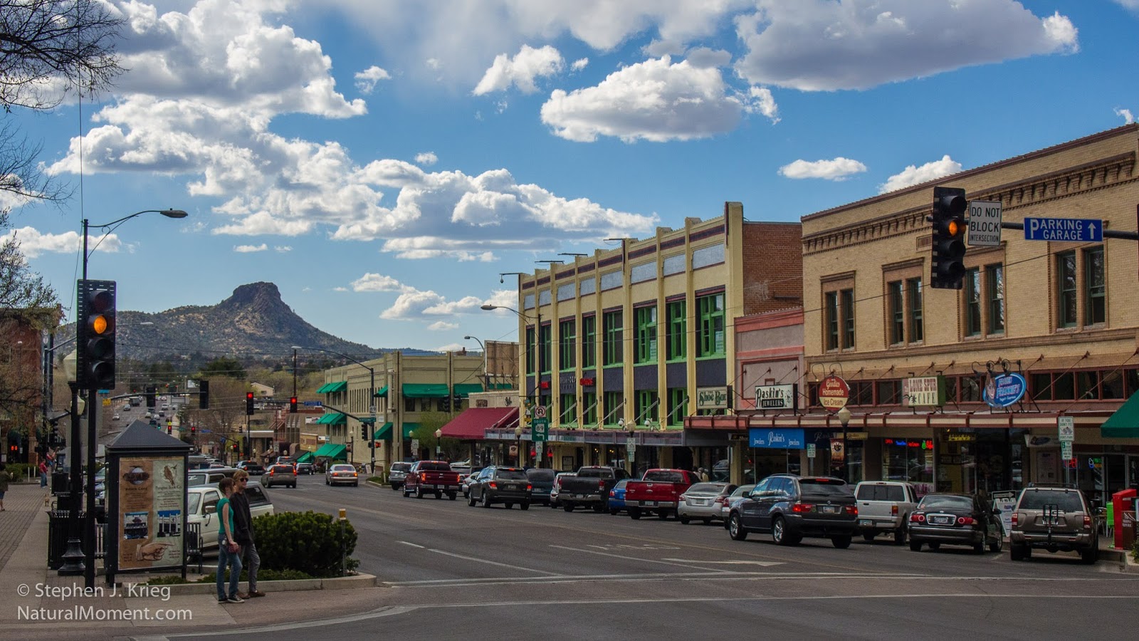
Gurley Street, looking west toward Thumb Butte
I had most of the day to wander as I felt like, having dropped my vehicle off at a local auto repair shop for some good upgrade work to engine and brakes. I had intended to spend most of my time in the Sharlot Hall Museum, but to my delight some gorgeous, ever changing cumulus clouds had shown up. And the air was crisp and clear. A photographer's playground. Time to play "local tourist", exploring like a rubbernecking newcomer but with the familiarity of a resident. The best of both worlds.

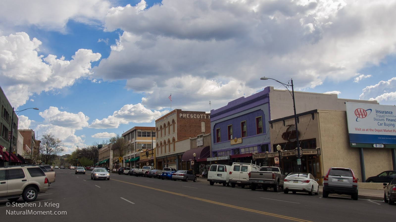
Gurley Street, looking east from Courthouse Plaza ("the Square")

I like downtown Prescott because it has a number of old, historic buildings that are inhabited by local businesses. No chain stores or restaurants here. With the beautiful light and plenty of time on my hands I decided to wander the streets as a tourist would. I had only lived in the area a year, and so it would be a chance to visit some of the shops that I hadn't yet, as well as re-visit those I knew already, to see what had changed.


The beautiful Hassayampa Inn on Gurley Street
The downtown core is centered around the Yavapai County Courthouse, a stately granite building surrounded by the lawns and sidewalks and American elm trees of its plaza, universally called "Courthouse Square" or "the Square" by the locals even though the city maps and signs insist it's officially Courthouse Plaza. 

Whiskey Row (right), Montezuma Street across from the Courthouse Plaza (left).

On the north side of the Square is Gurley Street, which is Prescott's Main Street. Gurley Street comes down the hill from the east at the beautiful red-brick Hassayampa Inn and the Elks Theatre, and points west toward Thumb Butte, the iconic upthrust on the Prescott National Forest just west of downtown.

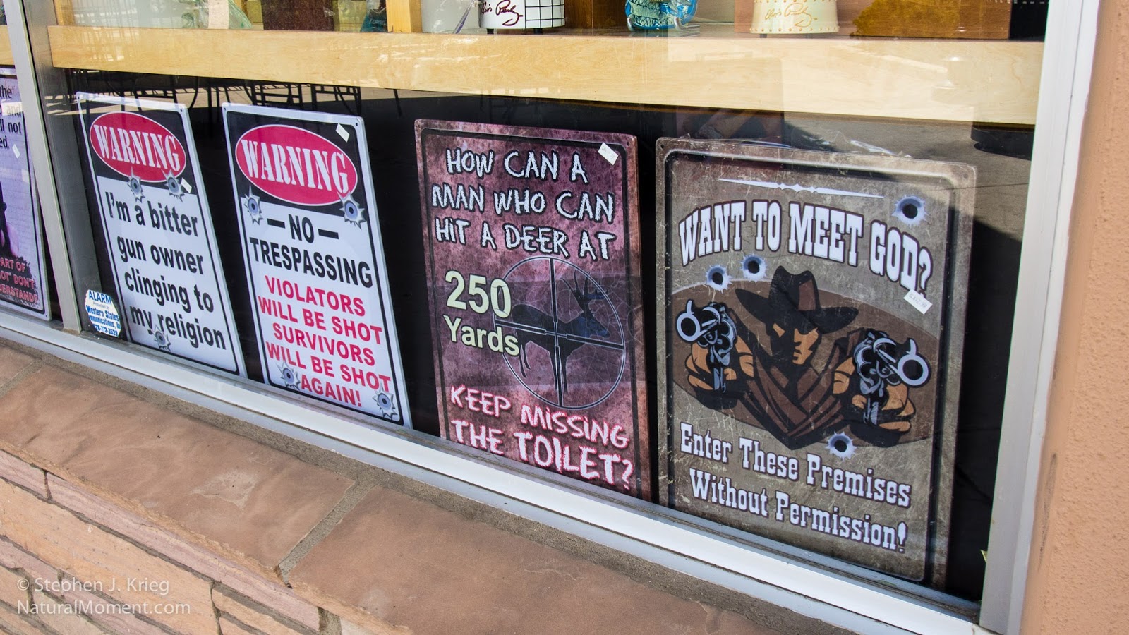
Gun lovers' signs for sale.
Prescott revels in its "Old West" cowboy, pioneer, and mining history. Also in being a mile high in elevation, making its climate about as perfect as you can get. With the iconic Arizona blue skies, low humidity, and moderate temperatures, Prescott is off the beaten path (Interstate 17) while being not that far from it, either. 

Alongside Courthouse Plaza to the south is Whiskey Row, that block of Montezuma Street with a very colorful (i.e., wild) past and is still the epicenter of downtown's night life. With a number of bars, art galleries, restaurants, and upscale shops, it's a great place to browse and spend an hour or three. And that's during the daylight hours! Wyatt Earp and Doc Holliday are long gone from the scene, but downtown lives on as a mixture of historic and modern. 

 
Hotel St. Michael ("St. Mike's") building anchors the north corner of Whiskey Row

Mountain Spirit Co-Op art gallery and healing center on Cortez Street
However, Cortez Street just north of Gurley Street rivals Whiskey Row for having at least as many restaurants, and with even more shops. At any rate, all of historic downtown Prescott is within easy walking distance, and is very pedestrian-friendly.

Cortez Street Emporium (and mirror for lovely Arizona sky).

The Cortez Street Emporium makes it plain when it's open...and where the entrance is!

Visual collage of inside and outside, near and far, courtesy of the Cortez Street Emporium's front windows.
 
Along Cortez Street

North Cortez Street, Prescott, Arizona

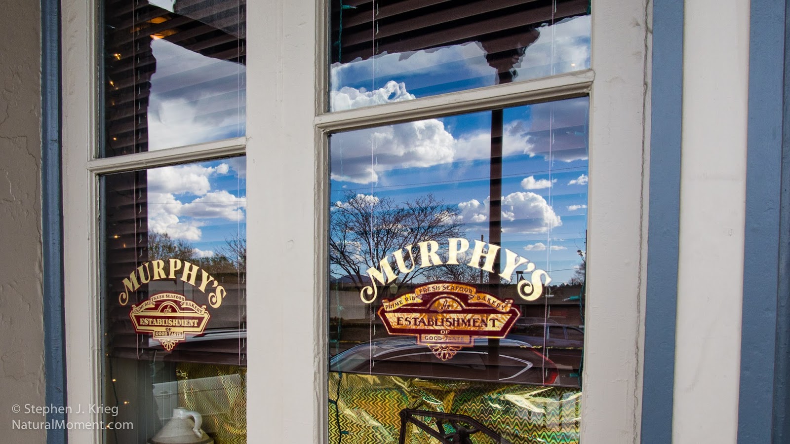
Murphy's Restaurant, Cortez Street

Wandering "local tourist" photographer...

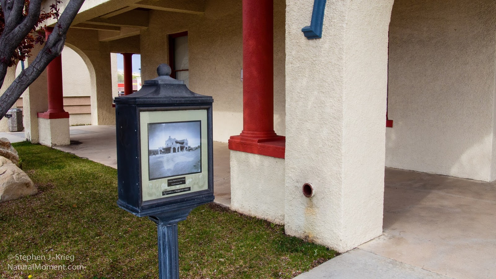
The former train station is now an upscale professional building.

Historic photo from the Sharlot Hall Museum archives shows the train station in its day.

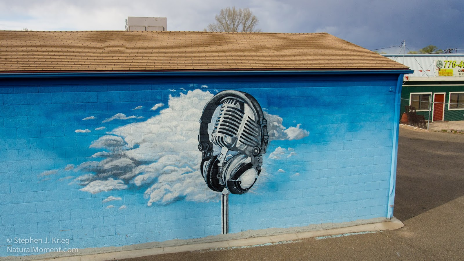
Local businesses aren't shy about turning their walls into public art.
Streetside art on The Lone Spur Cafe, Gurley Street
Adams Specialty Automotive Repair shop, my beginning and ending point near historic downtown.
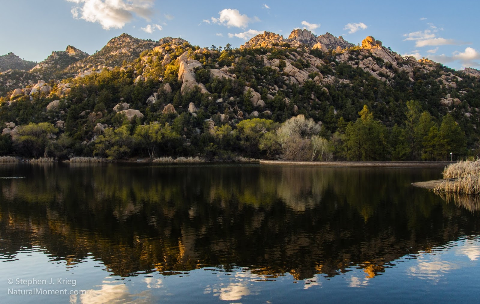
Granite Basin Lake and Granite Peak, on the Prescott National Forest a few miles west of downtown. Gotta take the vehicle for a little drive after being worked on!
Prints and photo products are available on my Fine Art America sales website:
http://stephen-krieg.pixels.com/


© Copyright 2014 Stephen J. Krieg