Monday, June 3, 2013

Clouds Make the Sunset

Photo: Sunset beams, Chino Valley, Arizona. [Click on image for larger version]
Sunset time. Always beautiful if there aren't too many clouds obscuring the western horizon. For the scenic photographer, though, no clouds at all makes for a relatively boring sunset. Why? Because the right kind of clouds, in the right location above the setting sun, reflect and intensify the colors. Too many  clouds, or too low on the horizon, cut off the sun's rays. At the other extreme, no clouds at all and it's merely a little yellow ball sinking out of sight. 

As this photo shows, it doesn't take many of the right kind of clouds to dramatically enhance the sunset colors. A few puffy clouds above the horizon and there you have it. The moisture in the sky made the sun's rays stream out into sunset beams, and the clouds acted as reflectors of the warm yellow colors.

Photo Location: Little Chino Valley, Yavapai County, Arizona.

---------------
My YouTube Channel: naturalmoment | my website: NaturalMoment.com

All content © Stephen J. Krieg. Prior permission required for usage.

---------------

Friday, May 24, 2013

May Moonrise, Lonesome Valley

Today was full moon Friday, time for May's Full Moon. It would be "100% illuminated", as the scientists say, at about 9:30 PM. After dark, that is.

So, the time to make moonrise shots was around sunset time, before it got too dark. The moon would rise early enough to make it happen. Who cares, or could tell, that it would only be 99.999% illuminated at that time?

Lonesome Valley basalt butte and Granite Mountain (far horizon).
I was in place at the north end of Lonesome Valley, in the central highlands of Yavapai County, Arizona. The basalt buttes and the distant skyline of Granite Mountain provided a nice sunset light scenic to the southwest. 

Then, my attention was to the southeast, toward Mingus Mountain and the Black Hills, where the moon would appear. 

It was a calm, peaceful late spring evening, and nobody was around. The Earth's shadow made its familiar gradation from blue to pink. Then the moon began edging over the horizon of the mountains. Perfect. 

And it was. I made several exposures from wide angle, which showed the Earth's shadow colors better, to medium telephoto, with the mountains larger within the frame. 

Then it was time to go back to my studio and see how I did. Now you can see, too. 

Sunday, May 12, 2013

High Desert Reading Room


A perfect May afternoon in the Central Arizona Highlands of Yavapai County: not just the trademark Arizona blue sky, but also featuring perfect cumulus clouds for an added, slowly changing treat. 

I pulled over at one my my favorite spots at the north end of Lonesome Valley. Time to kick back, drink some water, eat a snack, watch the afternoon go peacefully by. Savor and savor some more until the sunset hour arrived.

I was reading Ellsworth Kolb's Through the Grand Canyon From Wyoming to Mexico, the first person account of he and his brother Emery's famous river expedition that captured the first motion pictures of running the wild river, way back in 1911-12. Being professional photographers, their equipment was their life, especially on that hazardous trip.

Meanwhile, here I was about a hundred years later, with my jewel of a digital camera to photograph with on a lazy spring Saturday, about 80 miles south of Grand Canyon. I was in such a perfect spot that I actually took some of my photos from the cab of my pickup truck, while reading the book. Not exactly an expedition. Just incredibly satisfying.

Then I got the idea of shooting a panoramic image from inside the truck, using it as the frame to the scenery I was reveling in. Even a clip of video. To document my mobile reading room.

The Kolb brothers would have appreciated it, I'm sure. Get the shot, no matter how hard, or how easy.

Tuesday, April 30, 2013

Lonesome Valley Basalt Buttes


From the town of Chino Valley in the Central Arizona Highlands I drove east on Perkinsville Road for another sojourn into the hills at the north end of Lonesome Valley. 

A dry early spring. Little rain. Some of the high desert shrubs and forbs and wildflowers appearing, but overall the grasses seem to be waiting for some real moisture. Meanwhile, the blonde prairie grasses, dead since last summer, provided the soft straw yellow coverings to the land. 

The basalt lava buttes here have no names, so I have to make up my own. The double hump on the left is called Was A Pair, since the one hump is much more eroded than its twin. Behind them to the right is Nipple Butte, though it doesn't look like its namesake from this viewpoint. 

Photo location: Lonesome Valley, east of Chino Valley and north of Prescott, Yavapai County, Arizona.

Wednesday, April 10, 2013

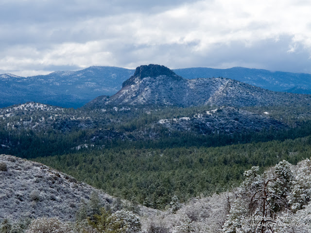
Spring Snow, Prescott Basin

Photo: Thumb Butte and the Bradshaw Mountains, near Prescott, Arizona

April 9 dawned cloudy but clearing. Snow had fallen after rain, hopefully soaking the ground enough to trigger grasses and wildflowers soon. 

The clouds began to break up at sunrise. Traveling west from downtown Prescott on Thumb Butte Road I wound my way up into the hills. The snow coating on the trees and shrubs, along with the brilliant light, made for a wonderful batch of new photos. 

In this photo from Skyline Drive above Happy Valley, Thumb Butte and the Bradshaw Mountains were given bright but soft light through the dissipating clouds.

Photo location: Skyline Drive, Prescott, Arizona

Wednesday, April 3, 2013

Moon Over the Black Hills

The Black Hills in Yavapai County form the eastern edge of the Prescott valley basin.

Here, from the northern end of Lonesome Valley, the Black Hills darken in the Earth's shadow just after sunset.

Yavapai County, near Chino Valley, Arizona.

Sunday, March 24, 2013

Evening Cows, Coconino County


Cattle at sunset amongst the volcanic cinder cones at the northern edge of the San Francisco Volcanic Field, north of Flagstaff, Arizona.

Friday, March 22, 2013

Canyons Sunset Color Palette, Yavapai County

High desert sunset colors, north of Prescott, Arizona
Cruising the back roads of northern Yavapai County, north of Prescott, Arizona. It’s early spring in the mile-high desert, that time of year between intermittent winter snows and the first plant growth of the season. 

East from Chino Valley on Perkinsville Road. A stop at the Verde River near the ghost town of Perkinsville (inaccessible to the public except by riding the Verde Canyon Railroad), then more wandering on the public National Forest roads. Lots of open country. Dry and dusty, but high and wide, too.
 
The photographers’ Golden Hour has arrived. I find a turnout on a ridge along the Perkinsville-Jerome Road. Clear views all around, but especially to the northeast, where the red rock cliffs west of Sedona are prominent. In the far distance the snow-capped San Francisco Peaks, about 80 miles away up at Flagstaff.

As the sun nears the horizon behind me, the color temperature warms the light on the scenery. The reds and pinks of the various rock layers, the dark greens of the juniper and pinon pine trees, the hazy blues and purples of the distant hills and mountains.

All is well. Sun below the horizon, warm colors extinguished. Cool dusk.

A bit more lingering, then the return drive home.

[Click on the photo to see a much larger, more detailed version]

Monday, March 18, 2013

From Chino


Mid March in mile high Yavapai County in the central Arizona highlands. Waiting for spring to arrive. Cruising the back roads, enjoying nature, open vistas, and freedom. 

South of Chino Valley I stopped at a scene partially overlooking a solar panel power generating station. Some storm clouds provided a beautiful palette of blues, grays, and whites against the sky, and bands of sunlight and shadow on the ground. 

On the far skyline is the lumpy silhouette of Bill Williams Mountain, up on the Coconino Plateau at Williams, Arizona.

Chino Valley, Yavapai County, Arizona

Friday, March 1, 2013

Another Moonrise


The nearly full moon rises above the winter-bare grasslands of Williamson Valley north of Prescott in late February 2013. The Earth's shadow just after sunset provides the blue-to-violet color gradation.

Williamson Valley, Yavapai County, Arizona.

Saturday, February 23, 2013

February Foray, Arizona Desert Highlands


[Photo: US 89 from Desert Viewpoint on Yarnell Hill]
I decided to go on a little Saturday drive.

So I headed out of charming Prescott, Arizona's Mile High City*, on US 89. Up over the Ponderosa pine forested mountains south of town, and down the winding switchback highway into tiny Wilhoit. 

Not much there at all, but I liked it anyway, maybe just to be out of the snowy highlands for a while. I sure did like the view from the stone walled roadside overlook on the way down the mountain. There was enough haze to make the blue and purple desert mountain ranges to the west appear even more far off and mystical.

Continuing south and steadily lower in elevation, I enjoyed passing through the beautiful horse heaven of Peeples Valley, and down through quirky little old mining and ranching town of Yarnell, to Congress. I was down in the desert, with prickly pear, cholla, and even some saguaro cacti around. The relative warmth in late February felt and smelled especially spring-like. Sweet and relaxing.

[Photo: US Hwy 93 north of Congress, Arizona]

At that point I swung back north through the desert via US 93. This section of road is named the "Joshua Tree Forest Parkway of Arizona". Properly spelled Joshua-Tree because it's a large member of the yucca family rather than a true tree, there were plenty of these fascinating desert plants along both sides of the road.

[Photo: Moon and Joshua-Tree along US 93]
It was two days before the February Full Moon, which means it would rise over the eastern mountains well before sunset. And it did. 


[Photo: Moon over the desert mountains, about 5:15 PM]

I stopped along the highway to make some compositions with the mountains and the Joshua-Trees, along with an interesting ranch gateway. 

[Photo: Moon and DG Ranch Gate, US 93]


[Photo: Windmill and nearly full moon at sunset, State Route 97]
Leaving Highway 93 north onto State Route 97, I stopped just before the sun dipped behind the western mountains to pair the moon with a windmill pumping water into a water tank for cattle. 


[Photo: Dusk at the Santa Maria River]
Driving east in the dusk on S.R. 96, I crossed the Santa Maria River for the last photo of the day. After driving across the bridge, I parked so I could walk onto the bridge for my intended shot. A heron in silhouette flew south along the river toward wherever its roosting place was for the night.

Finally, it was more desert and canyon driving in the dark, then up over the mountains through the Prescott National Forest via Skull Valley, and back down into Prescott.

So my little drive had turned into a ten hour, 180 mile foray; not unusual for me. Have Camera, Will Travel.

-------------------------

* That must make Flagstaff, 90 miles to the north and about 2,000 feet higher in elevation, Arizona's "Heck of a Lot Higher Than Prescott" City.

(Click on any photo to see a larger version.)

Locations: Yavapai County, central Arizona.

Tuesday, February 19, 2013

Mountain Winter Water, Quehanna


A clear, pure, rushing mountain stream in northern Pennsylvania in winter. Steep forested hillsides all around. Solitude. Excitement and reverence.

I walked up along the stream, around mossy boulders and through wild Rhododendron and Mountain Laurel bushes. 

In this photograph, the tiny waterfall is flowing diagonally across the composition. The spray from the water has frozen on the edges of the rocks as the stream lowers in volume.

Location: Quehanna Wild Area, Elk State Forest, Elk and Cameron Counties, northern Pennsylvania.

You might also enjoy my Grand Canyon Photography Blog [click here].

© Copyright Stephen J. Krieg

Saturday, February 16, 2013

Winter Falls, Quehanna Wild Area


Small waterfalls are some of the most beautiful. You can get close to them without getting sprayed, without risking your camera equipment. As long as you don't fall in the stream getting your camera and tripod into position, that is. 

In this photo, a long shutter speed allows the water to blur enough to give the feeling of it flowing and bouncing down the rock layers.

At an unnamed brook in the Quehanna Wild Area, Elk State Forest, Pennsylvania.

© Copyright Stephen J. Krieg

Saturday, February 9, 2013

Hills, Dells, and The Peaks


Winter in Prescott, central Arizona highlands. In between snowstorms, the days have been very pleasant. 

In this view north of Prescott, the Granite Dells and Watson Lake are visible. On the far horizon the San Francisco Peaks shine almost ethereally with a fresh coat of snow, 90 miles away at Flagstaff.

Wednesday, January 23, 2013

Winter Golden Hour 2, Granite Dells, Arizona

[Photo: Granite Dells and water tank, late afternoon]

On this hike into the Granite Dells north of Prescott, Arizona, I approached the Dells from the east, using the Iron King Trail. It was about three miles across the flats of the Antelope Hills area, skirting the northern base of Glassford Hill. 

It's four miles from the trailhead at Glassford Hill Road to the junction with the Peavine Trail. Both trails use abandoned railroad grades that were originally built in the late 1800s. They were the first rail service to Prescott from the Santa Fe mainline north, and to the rich copper mines south in the Bradshaw Mountains.

About three miles in, you finally get to the edge of the Granite Dells. There are a few of the historic little railroad cars along the way, but no other interpretive signs until you get to the Peavine Trail. A sign or two as to how the railroad cars were powered, and what they carried, would be a nice addition. 


Sunlit grasses in the Granite Dells at evening

Once into the Dells, the landscape is infinitely more interesting. The slowly eroding granite rocks make for endless shapes and patterns. There are even still mountain lions in this area, along with coyotes and javelina. The Dells are surrounded by open ranch land and developed subdivisions, but the ruggedness of this relatively small area of rocks provides enough sanctuary for at least a few mountain lions. 


Water tank reflection, Granite Dells
At this point there was a "tank" or pond that had plenty of water, even in this dry winter. A lone mallard duck made some ripples on the otherwise mirror surface as I approached, but seemed too used to people visitors that it didn't bother to fly away. The surface of the water intensified the saturation of the blue sky reflection, and the rocks framing the tank.


Railroad car, Iron King Trail, Granite Dells
It was also near this point that there was another old railroad car. The granite rocks, clear blue Arizona sky, and the low sunlight provided a very nice composition.

It was the evening golden hour, and the color temperature was getting ever warmer as the sun approached the western horizon. 


Sunlit grasses, Granite Dells
Besides the obvious artistic attraction of all the rock formations, the dead golden grasses were lit up by the sunlight. Where there was a convenient area of shadow behind the grasses, the contrast made for some striking photos. Dead grasses continue to provide beauty long after their season-short life cycle is over. 


Granite spires, Point Of Rocks, Granite Dells, Prescott, Arizona

Finally I was to Point of Rocks. Besides the fantastic vertical granite spires and boulders, this was where the two railroads joined. There was even a train depot here. All that remains is a cement slab. 

One of the most photogenic stone formations is right near the Peavine Trail here. It is a twin monolith of granite, like two stone tablets set in the bedrock. One can't help but think the Ten Commandments would go well on them. Though I'm glad that they are unaltered. 


"Stone Tablets", Granite Dells, Prescott, Arizona

At this time of the year, the almost-set sun lit up the Tablets while their base was in shadow, as if a spotlight was on them. The deep blue sky and the tree in the middle background were very nice additions.


Granite rock spires, Granite Dells, Yavapai County, Arizona

Zooming in on some of the other vertical stone formations set against the blue sky. The shadows help to provide detail and a feeling of depth.

Point Of Rocks at sunset, Granite Dells, Prescott, Arizona
Alternately, going wide with the zoom lens reveals a composition of twin arcs provided by the golden-lit rocks, and the shadows of some other rocks formations off to the left. 
Sunset on Point Of Rocks, Granite Dells, Prescott, Arizona

One more look at the pointiest rock formation before the sun slid beneath the horizon. Then it was time for the four mile walk back to the trailhead. The first couple were in twilight, but the last couple were total darkness.

>> See more of my photography on my Google+ page at +Stephen Krieg Photography


Wednesday, January 2, 2013

Winter Golden Hour, Granite Dells, Arizona


This is why photographers call it the golden hour, the first hour of daylight and the last hour in the evening.

I was walking part of the Peavine Trail, an historic railroad grade converted to a nonmotorized trail. This portion went south, into the north end of the fascinating Granite Dells area. As I walked south, the distant bulk of Granite Mountain stood light blue on the horizon to the west. The foreground prairie was yellow in the late afternoon winter light. The jagged outlines of some of the dells formed the middle horizon.

A patch of dead yellow weeds along the edge of the railroad grade stopped me in my tracks. The low angle of the sunlight lit up the paper thin leaves, especially against the deep shade in the background. I love having some of the most common things brought to my attention by the light. 

After a couple of miles of walking, the upright rock formations of the Dells approached. This granite layer is said to have formed two or three miles beneath the Earth's surface. Whatever layers were above it have been eroded away. Continuing erosion shapes the fantastic spires and boulders, eventually reducing them to gravel and sand. Things falling apart create the most amazing shapes and patterns.

This area was named Point of Rocks by the railroad people. To the north is mostly open prairie. 

I had arrived at the perfect time of day. The sun was near the western horizon, warming the color on the rocks. I made a number of photos of different composition. But the light changes by the minute at this time, so it was going to be over quickly. 

And it was. Then I retraced my steps, walking back to the trailhead in the deepening dusk.


Yavapai County, Arizona, north of Prescott.

Prints and photo products are available on my Fine Art America sales website:
http://stephen-krieg.pixels.com/

© Copyright 2013 Stephen J. Krieg

Tuesday, January 1, 2013

Mountain Ranch in January, Northern Arizona

[Photo: Morning, Pittman Valley and Sitgreaves Mountain, Coconino County, Arizona.
Click on image for larger version.]
Snowy scenery on a still, frozen winter morning in the Pittman Valley of northern Arizona. Coyote tracks are the first visible sign on the snow's surface after a winter storm passed through.

In the distance is the long, lumpy form of Sitgreaves Mountain, an extinct lava dome volcano.

Between Parks and Williams, Coconino County, Arizona.

Frozen Tracks, Winter Sunrise, Pittman Valley, Arizona

[Photo: Sunrise snowscape and Sitgreaves Mountain, Arizona.
Click on image for larger version.]

Wouldn't it be wonderful to live in a winter landscape and never need a house, clothing, or money? Everything is available to the coyote and the other residents of wildlife. 

A frozen January sunrise brings blue shadows, bright snow shapes, and ethereal ground fog to a mountain meadow traversed by a few tracks during the night.
Pittman Valley, Coconino Plateau, west of Flagstaff, Arizona. At upper right is Sitgreaves Mountain.