Saturday, December 31, 2016

Bears Ears National Monument: The Bears Ears Buttes

Bears Ears Buttes and rainbow, San Juan County, Utah.
Rainbow and Bears Ears Buttes, from Natural Bridges National Monument.
Bears Ears National Monument was declared by President Barack Obama on December 28, 2016. The new National Monument is comprised of 1.35 million acres in San Juan County in southeast Utah.

Bears Ears Buttes from Natural Bridges National Monument, San Juan County, Utah.
Bears Ears Buttes from Natural Bridges loop drive along White and Armstrong Canyons.
 In the very center of the National Monument are its namesake, the Bears Ears Buttes, up on South Elk Ridge overlooking the northern edge of Cedar Mesa and Natural Bridges National Monument.

This post will introduce those not familiar with this area to the Bears Ears Buttes themselves. Subsequent posts will show the other areas of the Monument.

Bears Ears Buttes and moonrise, San Juan County, Utah.
Moonrise over the Bears Ears in winter, from Natural Bridges.
The designation of Bears Ears National Monument by presidential Executive Order, invoking the Antiquities Act, is contentious, as are all public land management issues. However, it is pertinent to note that Utah's "Mighty 5" National Parks -- Zion, Arches, Canyonlands, Capitol Reef, and Bryce Canyon -- all started out as National Monuments declared by presidential Executive Order, as well. All five were later upgraded to National Park status by Acts of Congress, which has the sole power to declare National Parks. The "Mighty 5" are tremendous tourist draws for visitors from around the world.

Bears Ears from Highway 261 on Cedar Mesa, San Juan County Utah
Panorama of Bears Ears after a late spring snow, from Highway 261 on Cedar Mesa.
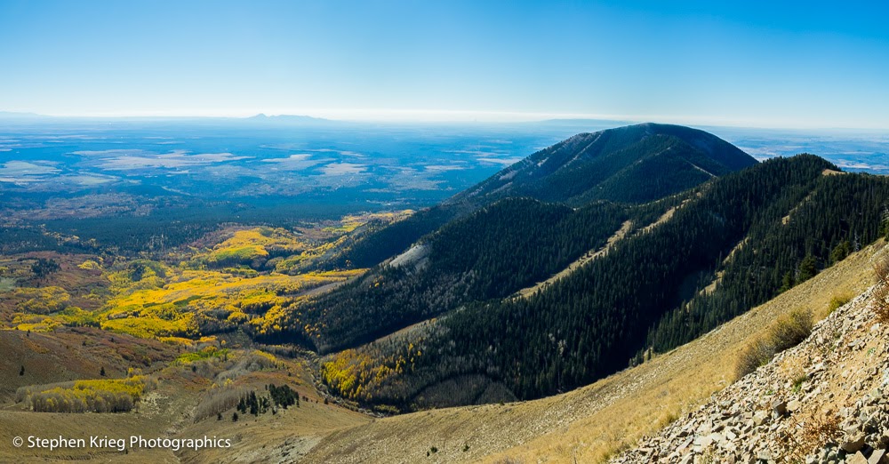
Bears Ears is of a vast size, with greatly varied life zones. They range from high desert to subalpine forest. In this area you can drive from the desert of the lower San Juan River valley to the Ponderosa pine, aspen and spruce-fir forests above 8,500 feet elevation in an hour or less.

East Bears Ears Butte from South Elk Ridge, San Juan County, Utah
East Bears Ears Butte from mountain meadow on Forest Road 88.
There are three main areas of Bears Ears National Monument. From north to south are the Indian Creek area bordering the Needles District of Canyonlands National Park, the Elk Ridge area of the Manti-La Sal National Forest, and Cedar Mesa, home to countless Ancestral Puebloan sites.

Wintertime scenic of Bears Ears and Elk Ridge from Natural Bridges
Utah Juniper snag and Bears Ears Buttes in winter, from Bridge View Drive loop in Natural Bridges National Monument.
Both West Bears Ear (elevation 8,929 feet at its summit) and East Bears Ear (8,908 feet) are at the south end of South Elk Ridge, on the Manti-La Sal National Forest. From Utah Highway 275 (the Natural Bridges entrance road) you can drive north on Forest Road 88 (when the road is not muddy) and go right between the two Bears Ears Buttes on your way to accessing the rest of the Elk Ridge area.

Monsoon season thunderhead clouds over Bears Ears Buttes, Utah.
Bears Ears Buttes and South Elk Ridge with monsoon season thunderhead clouds.
The name Bears Ears came from Native American tribes in the region that consider these landmarks to be sacred, especially since they can be picked out on the horizon from as far away as Monument Valley and Mesa Verde National Park in southwest Colorado.

Bears Ears from mountain meadow on Manti-La Sal National Forest, Utah.
Bears Ears Buttes from the north, in an alpine meadow on South Elk Ridge.
Except that the ears of bears are roundish, not flat! What gives? It has to do with an old Navajo legend, of which there are at least two variations. Perhaps the other area tribes have their own versions as well. The best known legend is a gruesome one, in that Changing Bear Maiden was killed by her brothers after she had turned to the "dark side" and had become an evil bear, after which they chopped off her ears. That's why the "Bear's Ears" are flat. Like many Indian legends, it is meant to teach the difference between good and evil, of choosing the right path in life.

Forest Road 88 at Bears Ears Pass, Manti-La Sal National Forest, Utah.
Forest Road 88 on the Manti-La Sal National Forest goes right through the pass between the two Bears Ears Buttes.
The Bears Ears and Cedar Mesa area are beloved by locals and non-local visitors alike, for driving, hunting, hiking, and camping. The area is still used by area Native American tribes for collection of edible, medicinal, and ceremonial plants and their fruits and nuts. This will be the first National Monument to be co-managed by representative of those tribes, in conjunction with the Bureau of Land Management and USDA Forest Service.

Bears Ears and Elk Ridge from Blanding, Utah
Bears Ears Buttes and Elk Ridge from Blanding, Utah.
Photo location: Bears Ears Buttes, Manti-La Sal National Forest and from surrounding public lands administered by the Bureau of Land Management and National Park Service (Natural Bridges National Monument), San Juan County, southeast Utah.

Bears Ears panorama with rainbow, San Juan County, Utah.
Rainbow panorama, Bears Ears Buttes.
© Copyright 2016 Stephen J. Krieg


Sunday, December 25, 2016

Winter Time at Arches National Partk

Visitors at Delicate Arch, December 20. 

Winter is the time to visit Arches National Park. The park has become so famous that it's almost un-visitable (if that's a word) for most of the year. Crowds, full parking lots, dumb visitors stopping their cars in the road to jump out and take pictures, blocking any traffic behind them. The National Park Service has weighed all options to relieving the overcrowding. Don't be surprised if they feel they have to go to a reservation system before long. Yes, just to drive into the park. That's how bad it's gotten.

Wintertime is much better, the only time I go there any more. The town of Moab is uncrowded, the motel rates are very reasonable if you're staying overnight, and the weather is not unbearably hot like in summer. Finally, in winter the distant La Sal Mountains are shining in the sun with a fresh coating of snow. Better photos.

From the entrance station at Arches (only one lane open, and I was the only vehicle at the time, giving me time to chat with the Ranger on duty) it was a 30 min. drive to the trailhead to Delicate Arch at Wolfe Ranch. The parking lot was only about half full. The weather was chilly but sunny, quite pleasant for a hike.

The 1.5 mile long hike took a leisurely 45 minutes to the arch. There was a small crowd of people there, but if you waited a bit you could get a closeup of Delicate Arch with nobody standing underneath it for their selfie picture. Or get one with a human posing to show the scale. Your choice.

If you use your imagination, Delicate Arch looks like a cowboy's legs, with leather chaps. Bowlegged and all. Nothing above the belt, though.

Delicate Arch and the distant La Sal Mountains.

Photo location: Arches National Park, near Moab, southeast Utah.

© Copyright 2016 Stephen J. Krieg

Wednesday, December 21, 2016

Last Trout Before the Big Freeze

Waldens Lake and Abajo Mountains, December 17.
December 17 was my last day of trout fishing for the year. I caught my limit of four rainbow trout as usual, despite the cold and bitter wind. It was beautiful in the high country sunshine at 7,000 feet despite the wind.

Rainbow Trout, the last catch.
The next day a deep freeze moved into southeast Utah. A couple inches of snow, no big deal. But then low temperatures in the single digits (F.). And perhaps more importantly after the storm moved east into Colorado, the wind died. For days. Calm, no real breeze stronger than about 5 MPH. Which meant that there was no longer any strong wave action on the lake to keep busting up the thin shelf ice along the shoreline.

Abajo Mountains panorama on the last day of trout fishing.

I knew it was coming sometime. That's why I was out there fishing every day. Because each day could be the last of the season.

This day turned out to be the day.

© Copyright 2016 Stephen J. Krieg

Saturday, December 17, 2016

Choppy Lake Sunset Reflection

Sunset reflection and Abajo Mountains.
A cold sunset at the lake, wind whipping the water's surface to whitecaps. I had hopes for a colorful sunset -- the clouds looked to be positioned about right -- but the roiling lake surface would not do its part by providing a mirror surface reflection.

To my surprise, the sunset afterglow colors were so strong that it reflected off the waves, a wrinkled reflection of reds and blues.

Prints and photo products are available on my Fine Art America sales website:
http://stephen-krieg.pixels.com/


© Copyright 2016 Stephen J. Krieg

Sunday, December 11, 2016

Abajo Peaks: Sunset to Sunrise

Abajo Mountains, early sunset colors.
An early December evening at the lake. Until today, the sunsets had been devoid of colors for about a week. Why? Too clear, as in not enough clouds in the right position to create colors.

South Mountain and golden cloud bank, early sunset colors.
The recipe is pretty straightforward: Clouds over the setting sun on the western horizon, with a "slot" of clear sky below them. The clouds serve as a reflector screen for the just-set sun's rays to light up. So it's not the exact sunset time for peak colors, it's just past sunset. The afterglow.

Abajo peaks, late sunset colors.
On this particular evening, it was a double show of colors. The early colors were yellows and golds. I had thought that was the climax. But after another five minutes or so the clouds turned red. Never leave too early!
Abajo Mountains at sunrise.
The next morning the peaks were bathed in a soft golden glow for several minutes just after sunrise. From left to right: South Mountain, Abajo Peak (the tallest of the Abajos, at 11,360 feet (3,463 m), and Horsehead Mountain.

Photo location: Monticello, San Juan County, southeast Utah.

Prints and photo products are available on my Fine Art America sales website:
http://stephen-krieg.pixels.com/


© Copyright 2016 Stephen J. Krieg

Monday, December 5, 2016

The Iceman Cometh

Partially melted and refrozen ice "berries" on weed twigs.
I was at the lake last week to do more trout fishing, before the weather gets too brutal here at 7,000 feet in elevation. It gets me into the outdoors for several hours a day in a way that I otherwise wouldn't be. So it's good.

Standing in and walking around a relatively small area outside for hours allows me to relax into the scenery, the weather, while watching the birds move around doing their thing. Their things.

For instance, the other day when I got to the lake shore at my favorite, most productive spot, I saw that the lake was starting to freeze. Only in one small protected cove, but that's how it starts. It caused me to realize that I was going to get to watch the lake freeze over, stage by stage, for the winter. Then I will watch it lie dormant, frozen and snow covered through the "dead" of winter. Then watch it start to re-emerge in several months as springtime returns. I'm looking forward to that. I have the time, the convenient proximity to the lake, and the health to be out there daily if I want.

Early ice shelf on a protected cove on the lake.

Besides the beauty of the modest ice shelf itself, I became intrigued by some somewhat spherical "blobs' of ice that were on the stalks of weeds a few inches above the surface of the ice sheet. It wasn't hard to guess how they had come to be.

They formed when the lake level was as couple inches higher. It had been cold enough to freeze around the twigs a little bit, probably with a gentle lap of the water's surface with a gently breeze. That's my guess.

The Abajo Mountains in the distance, source of the lake's water.

Then the lake level dropped with the colder weather,  because the stream that feeds it reduced in flow as its headwaters in the mountain slopes above became frozen. The lake continues to evaporate slowly while its water supply from the mountains is all but shut off by winter's freeze up higher.

Ice berries on dead weeds, sparkling in the cold sunlight.

As for the ice "berries", the sunlight partially melted them during the day, while it stayed cold enough to not melt them entirely. Pretty amazing.

The ice berries were so gorgeous that I had to suspend my fishing to photograph them.

Rainbow trout, perfect pan frying size.
Photo location: San Juan County, southeast Utah.

Prints and photo products are available on my Fine Art America sales website:
http://stephen-krieg.pixels.com/


© Copyright 2016 Stephen J. Krieg


Friday, December 2, 2016

Snow Squall Lake Sunset

Snow showers at sunset time over the Abajo peaks.
I was at the lake, trout fishing. Yes, in late November at 7,000 feet. Pretty fortunate to have such cold (temperature near freezing) but not brutal winter weather yet. I'll take it as long as it lasts, because then it will be a long several months until spring.

Sunny most of the day, but lingering snow showers from the most recent light storm were cloaking the Abajo peaks. Like a veil dance they would cover, partially pull off, tease.

At the lake, the sun slid behind the southernmost peak, lighting the clouds from behind. A slight tinge of gold, but no strong reds this time. No matter. The spectrum of blues from light to dark to black, reflecting off the lake, was spectacular enough.

Photo location: Monticello, San Juan County, southeast Utah.

Prints and photo products are available on my Fine Art America sales website:
http://stephen-krieg.pixels.com/


© Copyright 2016 Stephen J. Krieg

Sunday, November 6, 2016

Winter Closes In: San Juan Mountains

Trout Lake, Colorado, after the fall colors.
I was back at Lizard Head Pass in the San Juan Mountains of southwest Colorado. Early November, and although rain and high elevation snow were about, it was rather warm for way up there at that time of year.

Sheep Mountain was lost in the clouds. My favorite peak was hiding.

Trout Lake was not. She was glassy, free of wind in the afternoon overcast light. The aspen leaves, with their vibrant fall colors, were long down.  But the the yellow dead grasses and forbs of the meadows had their own subtle glow.

New snow on Vermilion Peak, from Trout Lake, Colorado.
I stopped to photograph the last dangling golden leaves of a willow. In the wetness of the drizzling rain their color was that much more saturated.

Willow leaves in early November: last of the fall colors.
A cold front was moving in. I would have loved to have been there. But where would I stay? As many times as I've camped up there, the long winter nights seem even longer to me. I retreated to lower elevations. Like home.

Photo location: San Juan Mountains, southwest Colorado.

Prints and photo products are available on my Fine Art America sales website:
http://stephen-krieg.pixels.com/


© Copyright 2016 Stephen J. Krieg

Wednesday, October 19, 2016

Kachina Natural Bridge, Fall Colors

Kachina Natural Bridge, fall colors, from the Loop Road overlook.
It's mid October on the Colorado Plateau. Here in southeast Utah, Four Corners Country, the high country aspen fall colors are now gone. Now it's down to the lower elevations for the last of the colors. The cottonwood trees in the valley bottoms, in the canyon bottoms.

This is Kachina Bridge at Natural Bridges National Monument. The massive Cedar Mesa Sandstone walls are framed from below by the cottonwood and willow colors.

Photo location: Natural Bridges National Monument, San Juan County, Utah.

Prints and photo products are available on my Fine Art America sales website:
http://stephen-krieg.pixels.com/


© Copyright Stephen J. Krieg

Thursday, October 13, 2016

Fish and Fall Colors, Abajo Peak

Aspen fall colors and Blue Spruce, Abajo Peak Road.
October, the perfect month. Warm days, chilly nights, fall foliage colors. Here I am still in southeast Utah, enjoying the scenery, clean air, small town atmosphere, wide open spaces.

Rainbow Trout, perfect pan frying size, too.
Not only that but I recently bought my fishing license, after being away from it for decades. Following a tip from a local, I was soon catching my limit of four trout from a local lake. They are in the 9 to 12 inch range, perfect for pan frying.

Aspen at peak fall colors, Abajo Peak area.
 So having once again caught my limit that morning, I drove up Abajo Peak Road to see how the aspen colors had progressed in the past week. Pretty magnificent, at peak colors.

Aspen fall foliage backlit by the midmorning sunlight.
From up near the summit of Abajo Peak, I noted how the uppermost aspen clones, the ones that had turned the earliest, were now done, their leaves dropped. Now it was time for the lower elevation forest groups to show off their peak colors.

Looking southeast from Abajo Peak.
Photo location: Abajo Mountains, near Monticello, Utah.

Prints and photo products are available on my Fine Art America sales website:
http://stephen-krieg.pixels.com/


© Copyright 2016 Stephen J. Krieg

Sunday, October 2, 2016

Southwest Colorado Fall Colors

Colorado Blue Spruce trees in aspen stand, September 24.
I stopped in at the Sunshine Campground not far south of Telluride, Colorado on the Uncompahgre National Forest. I wasn't camping, I was looking for new views of aspen fall colors.

Quaking Aspen leaves at peak color, southwest Colorado.

Aspen leaves against a dark green background of spruce trees makes them look like they are shimmering.
There had been a dusting of early snow on the highest peaks.

 Photo location: San Juan Mountain Range, southwest Colorado.


© Copyright 2016 Stephen J. Krieg

Wednesday, September 28, 2016

Aspen Colors From Abajo Peak

Fall colors nearing their peak on the lower slopes of the Abajo Mountains, September 25.
The Abajo Mountains are a small mountain range near Monticello and Blanding in southeast Utah.

It's a small mountain range because in geologic terms it's a laccolith -- a spot in the Earth's crust where magma was forced to the surface without breaking the surface. No lava flow. More like a group of skin blisters that hardened in place.

The tallest peak is Abajo Peak, 11,330 feet in elevation at its summit. It's often called Blue Mountain by the locals, or even "the Mountain". It's public land, on the Manti-La Sal National Forest.

The aspen colors have been nearing their peak in the high country of Utah and Colorado. So on a sunny Sunday morning I drove up to the summit of Abajo Peak for a look around from above.

And in this photograph you can see how much elevation affects vegetation, in this case aspen forests. Notice how the aspen stands (clones, actually) at the upper elevations are at their peak fall color, while the lower slopes are still mostly green, just beginning to turn colors.

Photo location: Abajo Peak, Manti-La Sal National Forest, San Juan County, southeast Utah.

© Copyright 2016 Stephen J. Krieg

Tuesday, September 27, 2016

Fall Colors in Colorado

Historic Trout Lake Trestle, near Trout Lake, Colorado.
I was up in the San Juan mountain range in southwest Colorado again. Another high country fall season, another compelling reason to get back up there and experience it again.

For me the autumn colors of the aspen stands are the crowning glory of fall there. But there are many more subtle shades of color down low to the earth. Shrubs, forbs, grasses. Yellows, reds and browns set against the deep greens of the conifer trees.

For this photograph, I had been driving the forest road between Trout Lake and Lizard Head Pass. It pretty much follows the route of the historic railroad that ran there in the late 1800's. So it's an easy drive for any vehicle, since trains can't handle steep grades.

In this photo, I stopped to photograph the Trout Lake Trestle, with the mountain brook tumbling beneath it and one of the first snows of fall on the distant peaks.

Photo location: Uncompahgre National Forest south of Telluride, San Miguel County, Colorado.

© Copyright 2016 Stephen J. Krieg

Monday, September 19, 2016

Harvest Moon Over Cedar Mesa

Rise of the September Harvest Moon over White Mesa in southeast Utah. (Click on image for larger version).
For this month's Full Moon I had set up my tripod at Salvation Knoll on Utah Highway 95, between Blanding and Natural Bridges National Monument.

Salvation Knoll is a high point beneath towering red cliffs along the highway (at 7,110 feet) that affords sweeping views down across Cedar Mesa and even into southwest Colorado and northern Arizona.

The weather was favorable: clear and calm. In fact a bit more than favorable, in that some haze in the air would likely give the rising moon some color. Which it did.

Photo location: San Juan County, southeast Utah.

© Copyright 2016 Stephen J. Krieg

Friday, September 16, 2016

Utah Sunset: Monticello

The town of Monticello in southeast Utah sits at 7,000 feet and at the base of the Abajo Mountains. Small town atmosphere, clean air, and lots of outdoor recreation nearby on millions of acres of public land. Here is a recent sunset series from the edge of town.

© Copyright 2016 Stephen J. Krieg

Sunday, August 28, 2016

Chill Of An Early Fall?

Vermilion Peak, early snow, August 27.
This past week has been exceptionally cool for late August in Four Corners Country. Oh, sure, a weather anomaly can send you a respite from the summer heat for a day or two.

But not like this, and it looks to continue for a while at least.

Thus when I returned to Lizard Head Pass in southwest Colorado's San Juan Mountains I probably should not have been wearing shorts and a t-shirt. As I drove higher and higher up the Dolores River watershed, that became clearer and clearer. At the pass, it was hailing. Then cold rain. Then a break before repeating again and again.

A muddy campsite. Clouds shifting around the high peaks delightedly. Changing to warmer clothing. Cooking up a campsite stew, and coffee. Retreating to the vehicle in the hail and rain.

Savoring the views. Appreciating the experience.

© Copyright 2016 Stephen J. Krieg

Wednesday, August 24, 2016

Moonset Over Navajo Mountain

Full Moon moonset at dawn over Navajo Mountain.
I was on the southern rim of Cedar Mesa in southeast Utah for the August Full Moon.

The weather was pleasant enough for this time of year, breezy and not very hot. Wonderful for mid August. But it was semi-overcast on the eastern horizon, so my moonrise shots were brief, through a gap in the clouds.

I was camped on the rim, 1,000 feet above the San Juan River valley near Mexican Hat, and for most of the night got to enjoy a moonlit night.

At dawn it was clear, so I got up and waited for moonset. It looked like the moon was going to set right behind Navajo Mountain far to the southwest in Arizona.

And just as the almost risen sun tinged the moon a slight pink, I made this shot. I waited to see if I could get one of it actually starting to disappear behind Navajo Mountain, but a thin cloud bank on the western horizon made the moon disappear that much too early.

Photo location: Cedar Mesa, San Juan County, Utah.

© Copyright 2016 Stephen J. Krieg