Showing posts with label Abajo Mountains. Show all posts

Tuesday, May 9, 2017

The Great Sage Plain Greens Up

Winter wheat fields and Abajo Mountains, Dove Creek, Colorado
Going home, early May. Dove Creek, southwest Colorado.

Actually I had come up from the lower Dolores River at Slick Rock, enjoying the swollen river and the boaters floating down to their take-out landing.

Then I drove up over the landscape, over high mesas, and came back out to Highway 491. What a view. The fields of winter wheat so green in the cold wet springtime soil. The Abajo Mountains in the distance, in Utah 20 miles west. The wet skies dancing about, teasing a bit more rain.

Photo location: Dove Creek, Colorado.

See more of my photography at www.NaturalMoment.com.

© Copyright 2017 Stephen J. Krieg

Saturday, April 15, 2017

Moonset Over the Abajos

Moonset at sunrise, near Monticello, Utah.
I had been intending to take off in the other direction, until I exited my front door and saw the just past full moon setting over the Abajo Mountains. Hmm. Did I have time to do something about it? I did.

So I drove out to Loyds Lake on the edge of town. A favored vantage point. I quickly parked, grabbed my camera bag and tripod, and all but trotted down the gravel path. Because I could see there was no time to waste.

Loyds Lake at sunrise, with the moon setting over the Abajos.
 Whenever the moon is rising above the horizon, or setting in the other direction, it's amazing to see how quickly our Earth rotates compared to how we think of it (if at all) while we are caught up in the day. The frame of reference that the horizon brings is telling.

The moon was creeping down toward the still snowy Abajo Mountains west of town. The sun was rising as well, giving the landscape a warming glow while the moon was cool and blue. After all, it was still way out there in space.

Photo location: Monticello, southeast Utah.

© Copyright 2017 Stephen J. Krieg

Wednesday, December 21, 2016

Last Trout Before the Big Freeze

Waldens Lake and Abajo Mountains, December 17.
December 17 was my last day of trout fishing for the year. I caught my limit of four rainbow trout as usual, despite the cold and bitter wind. It was beautiful in the high country sunshine at 7,000 feet despite the wind.

Rainbow Trout, the last catch.
The next day a deep freeze moved into southeast Utah. A couple inches of snow, no big deal. But then low temperatures in the single digits (F.). And perhaps more importantly after the storm moved east into Colorado, the wind died. For days. Calm, no real breeze stronger than about 5 MPH. Which meant that there was no longer any strong wave action on the lake to keep busting up the thin shelf ice along the shoreline.

Abajo Mountains panorama on the last day of trout fishing.

I knew it was coming sometime. That's why I was out there fishing every day. Because each day could be the last of the season.

This day turned out to be the day.

© Copyright 2016 Stephen J. Krieg

Saturday, December 17, 2016

Choppy Lake Sunset Reflection

Sunset reflection and Abajo Mountains.
A cold sunset at the lake, wind whipping the water's surface to whitecaps. I had hopes for a colorful sunset -- the clouds looked to be positioned about right -- but the roiling lake surface would not do its part by providing a mirror surface reflection.

To my surprise, the sunset afterglow colors were so strong that it reflected off the waves, a wrinkled reflection of reds and blues.

Prints and photo products are available on my Fine Art America sales website:
http://stephen-krieg.pixels.com/


© Copyright 2016 Stephen J. Krieg

Sunday, December 11, 2016

Abajo Peaks: Sunset to Sunrise

Abajo Mountains, early sunset colors.
An early December evening at the lake. Until today, the sunsets had been devoid of colors for about a week. Why? Too clear, as in not enough clouds in the right position to create colors.

South Mountain and golden cloud bank, early sunset colors.
The recipe is pretty straightforward: Clouds over the setting sun on the western horizon, with a "slot" of clear sky below them. The clouds serve as a reflector screen for the just-set sun's rays to light up. So it's not the exact sunset time for peak colors, it's just past sunset. The afterglow.

Abajo peaks, late sunset colors.
On this particular evening, it was a double show of colors. The early colors were yellows and golds. I had thought that was the climax. But after another five minutes or so the clouds turned red. Never leave too early!
Abajo Mountains at sunrise.
The next morning the peaks were bathed in a soft golden glow for several minutes just after sunrise. From left to right: South Mountain, Abajo Peak (the tallest of the Abajos, at 11,360 feet (3,463 m), and Horsehead Mountain.

Photo location: Monticello, San Juan County, southeast Utah.

Prints and photo products are available on my Fine Art America sales website:
http://stephen-krieg.pixels.com/


© Copyright 2016 Stephen J. Krieg

Friday, December 2, 2016

Snow Squall Lake Sunset

Snow showers at sunset time over the Abajo peaks.
I was at the lake, trout fishing. Yes, in late November at 7,000 feet. Pretty fortunate to have such cold (temperature near freezing) but not brutal winter weather yet. I'll take it as long as it lasts, because then it will be a long several months until spring.

Sunny most of the day, but lingering snow showers from the most recent light storm were cloaking the Abajo peaks. Like a veil dance they would cover, partially pull off, tease.

At the lake, the sun slid behind the southernmost peak, lighting the clouds from behind. A slight tinge of gold, but no strong reds this time. No matter. The spectrum of blues from light to dark to black, reflecting off the lake, was spectacular enough.

Photo location: Monticello, San Juan County, southeast Utah.

Prints and photo products are available on my Fine Art America sales website:
http://stephen-krieg.pixels.com/


© Copyright 2016 Stephen J. Krieg

Thursday, October 13, 2016

Fish and Fall Colors, Abajo Peak

Aspen fall colors and Blue Spruce, Abajo Peak Road.
October, the perfect month. Warm days, chilly nights, fall foliage colors. Here I am still in southeast Utah, enjoying the scenery, clean air, small town atmosphere, wide open spaces.

Rainbow Trout, perfect pan frying size, too.
Not only that but I recently bought my fishing license, after being away from it for decades. Following a tip from a local, I was soon catching my limit of four trout from a local lake. They are in the 9 to 12 inch range, perfect for pan frying.

Aspen at peak fall colors, Abajo Peak area.
 So having once again caught my limit that morning, I drove up Abajo Peak Road to see how the aspen colors had progressed in the past week. Pretty magnificent, at peak colors.

Aspen fall foliage backlit by the midmorning sunlight.
From up near the summit of Abajo Peak, I noted how the uppermost aspen clones, the ones that had turned the earliest, were now done, their leaves dropped. Now it was time for the lower elevation forest groups to show off their peak colors.

Looking southeast from Abajo Peak.
Photo location: Abajo Mountains, near Monticello, Utah.

Prints and photo products are available on my Fine Art America sales website:
http://stephen-krieg.pixels.com/


© Copyright 2016 Stephen J. Krieg

Wednesday, September 28, 2016

Aspen Colors From Abajo Peak

Fall colors nearing their peak on the lower slopes of the Abajo Mountains, September 25.
The Abajo Mountains are a small mountain range near Monticello and Blanding in southeast Utah.

It's a small mountain range because in geologic terms it's a laccolith -- a spot in the Earth's crust where magma was forced to the surface without breaking the surface. No lava flow. More like a group of skin blisters that hardened in place.

The tallest peak is Abajo Peak, 11,330 feet in elevation at its summit. It's often called Blue Mountain by the locals, or even "the Mountain". It's public land, on the Manti-La Sal National Forest.

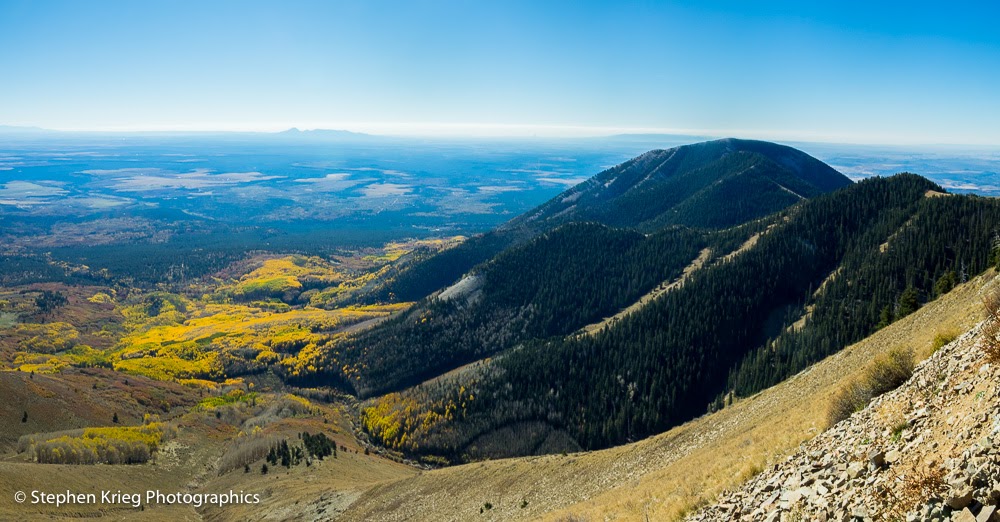
The aspen colors have been nearing their peak in the high country of Utah and Colorado. So on a sunny Sunday morning I drove up to the summit of Abajo Peak for a look around from above.

And in this photograph you can see how much elevation affects vegetation, in this case aspen forests. Notice how the aspen stands (clones, actually) at the upper elevations are at their peak fall color, while the lower slopes are still mostly green, just beginning to turn colors.

Photo location: Abajo Peak, Manti-La Sal National Forest, San Juan County, southeast Utah.

© Copyright 2016 Stephen J. Krieg

Friday, September 16, 2016

Utah Sunset: Monticello

The town of Monticello in southeast Utah sits at 7,000 feet and at the base of the Abajo Mountains. Small town atmosphere, clean air, and lots of outdoor recreation nearby on millions of acres of public land. Here is a recent sunset series from the edge of town.

© Copyright 2016 Stephen J. Krieg

Friday, January 16, 2015

Snowy Peaks, Red Rock Canyons

[Comb Ridge, San Juan County, Utah] 
A local friend calls Highway 95 west from Blanding, Utah "the road to the good stuff". And she should know, having combed this region for about 30 years. 

So I was again driving Hwy. 95 west, savoring the sights as usual. Up and through the massive cut in the red sandstone at the crest of Comb Ridge. Then down the west side, crossing Comb Wash. And up onto Cedar Mesa, the million-acre wild land with all the rugged canyons cut into its sides. Where everybody comes to hike down in to see the ancient Anasazi / Ancestral Puebloan cliff dwelling ruins that were last inhabited about 700 years ago. Great stuff. Part of my friend's "good stuff". 

Pulling over at a favorite viewpoint where I could see north from the lip of Cedar Mesa, I enjoyed the view toward Comb Ridge and the distant Abajo, or Blue, Mountains west of Blanding and Monticello. 
a
[Abajo Mountains through the clouds, from Cedar Mesa] 
This sums up a lot of what I appreciate about San Juan County: red rock canyons and snow capped mountains. Geology, archaeology, ecological diversity, and plenty of it.

© 2015 Stephen J. Krieg

Wednesday, October 29, 2014

Aspen Forest, Abajo Mountains, Sunrise

Up into the Abajo Mountains on the Manti-La Sal National Forest west of Monticello, Utah. Until now I'd only been able to admire this small mountain range from the edges, from afar. Now I had the time to start exploring them.

Quickly I was up into thick, tall, lovely aspen stands amidst the fir and spruce. The sun came up and lit the aspen trunks a pale gold. The towering shape of Abajo Peak made for a great background against the clear blue morning sky.

Photo Location: Manti-La Sal National Forest, San Juan County, southeast Utah.