Wednesday, May 11, 2016

Up Armstrong Canyon at Natural Bridges

Owachomo Bridge, in Armstrong Canyon, Natural Bridges National Monument
A fine May afternoon, and I decided to hike down to Owachomo Bridge in Armstrong Canyon at Natural Bridges. A slight chance of rain, but the clouds would accent the blue sky. Nicely, I hoped.

Down the easy trail to Owachomo Bridge.
I hiked underneath the stone bridge, oldest of the the three in the park, talking with visitors along the way. But most of them only go down to the bridge for pictures, then return to the parking lot, since it's only 0.2 miles away. A nice experience for those that don't want more.

The mouth of Tuwa Canyon, at Armstrong Canyon.
I hung a right and kept on going, over to the mouth of Tuwa Canyon where it enters Armstrong, a short distance upstream of the bridge. From there you can get some nice alternate shots of the area. 

Looking up Armstrong Canyon from a bench above.
I climbed up onto a bench above the stream, looking for ancient ruins and artwork. Suffice it to say that they are all over this area -- Cedar Mesa -- and half of the fun is looking without the aid of guidebooks or Internet secrets that have been given away, even pinpointed with GPS coordinates. 


Cattail pool, upper Armstrong Canyon.
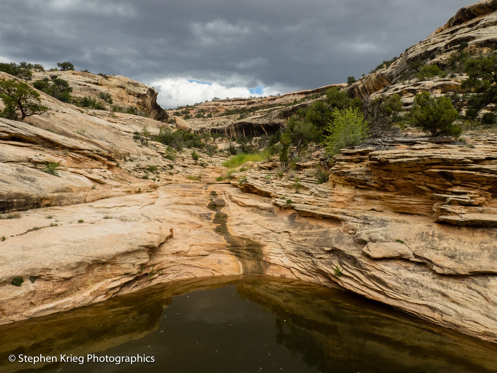
Then I descended from the bench and continued upstream, with pretty easy walking most of the way, following the stream course. One pool even had cattails growing along the bank. Cattails are one of my favorite marsh plants. I was surprised to see them there, since this is an intermittent high desert canyon stream, prone to flash floods. The cottonwood and willow trees are much better adapted to rip roaring floods. But cattails? Hmm. There must not have been a really bad rip roaring flash flood here for quite some time.


The springtime bright green flush of deciduous trees and shrubs in the high desert.
There was plenty of other streamside greenery: Fremont Cottonwood, Coyote Willow, rabbitbrush. Grasses and forbs.

Let's not forget the wildflowers. It's still springtime here at 6,000 feet, and the season has been nicely cool and wet. The hot weather will come soon enough, after all. Let the spring flowers feel comfortable taking their time.

Whipple's Fishhook Cactus blossoms.
First on the wildflower agenda, photographically, as far as this hike went: Whipple's Fishhook Cactus. Several had their first yellow-green blossoms out atop their needle-spine protected barrels of green. 

The Colorado Bladderpod have been blooming in the park for several weeks now. But they continue to eye-catch with their little bright yellow blossoms at the top of their flower stalks, each spreading out from the basal leaves in different directions, as if to cover various points of the compass. 


Colorado Bladderpod in bloom.
Meanwhile, up on the stream bank, it was impossible to miss another colony of Claretcup cactus in achingly red bloom. Like I don't have enough photos of this species, but it's hard to resist. 


Just another Claretcup cactus in bloom photo.
Finally I decided it was time to turn around and go home. But as I headed back downstream, I found some pure white Evening Primrose, wide open for business for the coming night (they are pollinated by nocturnal insects). 


Evening Primrose blossoms by the water's edge.
I climbed up a ledge on the north side of the stream bank, again looking for Ancestral Puebloan ruins. Didn't find any. But more red flowers caught my eye on the slope just above. I wondered: more Claretcups, or Paintbrush?

A clump of Paintbrush complemented by a green clump of something else.
It turned out to be both. One of the best clumps of Common Paintbrush (the much taller Wyoming Paintbrush appear later in the season) I've seen. I'm sure they hate being called "common". But they have no say in the matter, so I'm voicing it for them.

The so-called "Common" Paintbrush, closeup. Uncommonly eye-catching.
And just a few feet downslope, another small but photogenic colony of Claretcup cactus blossoms. I got close and personal this time, to show off the lovely structure of the blossoms.

Claretcup Cactus blossoms get their closeup portrait.
As I continued hiking, the rain started. Just sprinkles for a while. Then as I crossed back underneath Owachomo Bridge and ascended the trail, the rain became fat drops. But I was only a couple of minutes from my vehicle. Great timing.

Photo location: Natural Bridges National Monument, southeast Utah.

Prints and photo products are available on my Fine Art America sales website:
http://stephen-krieg.pixels.com/


© Copyright 2016 Stephen J. Krieg

Monday, May 9, 2016

Greater Canyonlands Rainbow Evening

Snow showers on the Abajo Mountains and Monticello, Utah.

It was a rainy weekend in southeast Utah, making driving on the dirt roads in the area a muddy possibility. And in the mountains of southwest Colorado more snow. 

Rainbow panorama.

So I opted to camp above the Needles District of Canyonlands National Park. Good roads, few people, outstanding scenery. This area outside the southern portion of the park is sometimes called Greater Canyonlands and has been proposed as a new National Monument.


Near Monticello, Utah I admired a storm cloud of snow and rain enveloping the Abajo Mountains. 

Rainbow closeup.

North of Monticello was the road to Hatch Point, my intended destination. I normally would have continued on to the Needles Overlook, but sunset time was nearing and I wanted to be further north. But on the way in a full rainbow slowed me down. 

Pronghorn buck with last patches of his winter coat.

I almost always see pronghorn in this area of high sagebrush. At this time of year the herds are split up, as the females have their young, each in their hidden spot, I suppose. Then I saw this big buck by the side of the road, almost unconcerned with me. I shot this photo of him right out the car window. Notice how almost all of his winter coat has been shed. 

Sunshine through the rain down along the Colorado River inside Canyonlands National Park.
The view to the west, over the side of the rim down into the Colorado River further slowed me down for photos. I loved how the sunshine lit up rain showers, with other buttes in shadow for dark contrasting shapes.

I did make it to my campsite shortly before sunset. The view down Kane Creek Canyon and to the Colorado River were dizzying and beautiful. 


Sunset time looking down on the Colorado River from near the Anticline Overlook.
To the east, the La Sal Mountains were showing off another late spring coat of new snow.


The La Sal Mountains just before sunset.


One of the peaks of the La Sal Mountains that was visible through the clouds.
Golden sunset rain showers over the Colorado River.


During the night I was treated to the peaceful sound of rain drumming on the roof of the vehicle. 

Photo location: San Juan County, southeast Utah.

Sunset on Kane Creek Canyon, from Hatch Point.
© Copyright 2016 Stephen J. Krieg

Friday, May 6, 2016

Deer Canyon, Utah

Deer Canyon in springtime.
A springtime hike up Deer Canyon in Natural Bridges National Monument. Another hike there, I mean. I'd been longing to return there, so I did.

Down into White Canyon to begin with. Beneath mighty Sipapu Natural Bridge, sixth largest in the world, as far as we know. A very special place, that's for sure.

Sipapu Bridge, with some hikers for scale.
Down the canyon. I'm enjoying the springtime flush of leaves on the deciduous species: Oak, Willow, Cottonwood. I love the winter snows here, but when they're absent I ache for the greenery of spring. No longer; spring is here.

Sipapu Bridge, from upstream.

Especially the wildflowers. 


Claret Cup hedgehog cactus, White Canyon.

Photo location: Natural Bridges National Monument (and environs), San Juan County, southeast Utah.

© Copyright 2016 Stephen J. Krieg


Saturday, January 23, 2016

Moonrise Over Bears Ears Buttes, Utah

December 2015 moonrise at sunset, Bears Ears Buttes.
The full moon scenery from Natural Bridges National Monument in southeast Utah couldn't have been more spectacular last month. 

With fresh snow on the Bears Ears, I went out two evenings before official Full Moon, for landscape shots at sunset. 

You have to be ready for Full Moon each month, because if the weather doesn't cooperate -- like this month -- you're shut out till next month.

Photo location: Natural Bridges National Monument, San Juan County, Utah.

© Copyright 2016 Stephen J. Krieg

Friday, November 20, 2015

Goosenecks Of The San Juan River, Goosenecks State Park

Goosenecks of the San Juan River, Goosenecks State Park, Utah.
Having been to southeast Utah's Goosenecks State Park a number of times, I'm always looking for the best conditions to portray this sprawling scene. 

This is my favorite shot so far. A bright sunny day, at mid day, with cumulus clouds to accent the blue sky and throw some shadows that help give the canyon slopes some sense of depth. 

The Goosenecks of the San Juan River is called "the world's most entrenched meander." It certainly is entrenched: a thousand feet down from the rims to the river. 

The Goosenecks are near the high desert hamlet of Mexican Hat, Utah. 

Nearby is one of my favorite areas, a section of Utah Highway 261 called the Moki Dugway. After driving up it another 1,100 feet you are on the southern edge of Cedar Mesa. The views of the lower San Juan River valley and toward Monument Valley are superb.

The Moki Dugway portion of Highway 261, north of Mexican Hat and the Goosenecks.

Photo location: San Juan County, southeast Utah.

© Copyright 2015 Stephen J. Krieg


Wednesday, November 11, 2015

Early Snow in Southeast Utah

November snow, south end of Moab, Utah.
It has been an early winter in southern Utah's high desert canyon country. 

This morning in Moab there was new snow on the cliffs and hills around town, and of course another fresh coating on the La Sal Mountains.
Snow on the red cliffs above Moab, Utah.
I drove north out of town, to I-70. Then east from Crescent Junction to get a few shots of the white stuff while it still adorned the south facing aspects of the Book Cliffs. Lovely, lovely.


Snowy Book Cliffs, Thompson Springs, Utah.
Photo locations: Moab and Thompson Springs, Grand County, Utah.

Prints and photo products are available on my Fine Art America sales website:
http://stephen-krieg.pixels.com/


© Copyright 2015 Stephen J. Krieg

Wednesday, October 21, 2015

Best Halloween Display Ever

Pumpkins take over Telluride at Halloween

Seen recently in Telluride, Colorado. Perhaps the perfect mountain town, even though it's overbuilt, trendy, and expensive? 

If anything, this display indicates they like to have fun and don't take things too seriously.

Telluride is a beautiful town.

Downtown Telluride, Colorado.
Ain't it?

© Copyright 2015 Stephen J. Krieg