Sunday, March 24, 2013

Evening Cows, Coconino County


Cattle at sunset amongst the volcanic cinder cones at the northern edge of the San Francisco Volcanic Field, north of Flagstaff, Arizona.

Friday, March 22, 2013

Canyons Sunset Color Palette, Yavapai County

High desert sunset colors, north of Prescott, Arizona
Cruising the back roads of northern Yavapai County, north of Prescott, Arizona. It’s early spring in the mile-high desert, that time of year between intermittent winter snows and the first plant growth of the season. 

East from Chino Valley on Perkinsville Road. A stop at the Verde River near the ghost town of Perkinsville (inaccessible to the public except by riding the Verde Canyon Railroad), then more wandering on the public National Forest roads. Lots of open country. Dry and dusty, but high and wide, too.
 
The photographers’ Golden Hour has arrived. I find a turnout on a ridge along the Perkinsville-Jerome Road. Clear views all around, but especially to the northeast, where the red rock cliffs west of Sedona are prominent. In the far distance the snow-capped San Francisco Peaks, about 80 miles away up at Flagstaff.

As the sun nears the horizon behind me, the color temperature warms the light on the scenery. The reds and pinks of the various rock layers, the dark greens of the juniper and pinon pine trees, the hazy blues and purples of the distant hills and mountains.

All is well. Sun below the horizon, warm colors extinguished. Cool dusk.

A bit more lingering, then the return drive home.

[Click on the photo to see a much larger, more detailed version]

Monday, March 18, 2013

From Chino


Mid March in mile high Yavapai County in the central Arizona highlands. Waiting for spring to arrive. Cruising the back roads, enjoying nature, open vistas, and freedom. 

South of Chino Valley I stopped at a scene partially overlooking a solar panel power generating station. Some storm clouds provided a beautiful palette of blues, grays, and whites against the sky, and bands of sunlight and shadow on the ground. 

On the far skyline is the lumpy silhouette of Bill Williams Mountain, up on the Coconino Plateau at Williams, Arizona.

Chino Valley, Yavapai County, Arizona

Friday, March 1, 2013

Another Moonrise


The nearly full moon rises above the winter-bare grasslands of Williamson Valley north of Prescott in late February 2013. The Earth's shadow just after sunset provides the blue-to-violet color gradation.

Williamson Valley, Yavapai County, Arizona.

Saturday, February 23, 2013

February Foray, Arizona Desert Highlands


[Photo: US 89 from Desert Viewpoint on Yarnell Hill]
I decided to go on a little Saturday drive.

So I headed out of charming Prescott, Arizona's Mile High City*, on US 89. Up over the Ponderosa pine forested mountains south of town, and down the winding switchback highway into tiny Wilhoit. 

Not much there at all, but I liked it anyway, maybe just to be out of the snowy highlands for a while. I sure did like the view from the stone walled roadside overlook on the way down the mountain. There was enough haze to make the blue and purple desert mountain ranges to the west appear even more far off and mystical.

Continuing south and steadily lower in elevation, I enjoyed passing through the beautiful horse heaven of Peeples Valley, and down through quirky little old mining and ranching town of Yarnell, to Congress. I was down in the desert, with prickly pear, cholla, and even some saguaro cacti around. The relative warmth in late February felt and smelled especially spring-like. Sweet and relaxing.

[Photo: US Hwy 93 north of Congress, Arizona]

At that point I swung back north through the desert via US 93. This section of road is named the "Joshua Tree Forest Parkway of Arizona". Properly spelled Joshua-Tree because it's a large member of the yucca family rather than a true tree, there were plenty of these fascinating desert plants along both sides of the road.

[Photo: Moon and Joshua-Tree along US 93]
It was two days before the February Full Moon, which means it would rise over the eastern mountains well before sunset. And it did. 


[Photo: Moon over the desert mountains, about 5:15 PM]

I stopped along the highway to make some compositions with the mountains and the Joshua-Trees, along with an interesting ranch gateway. 

[Photo: Moon and DG Ranch Gate, US 93]


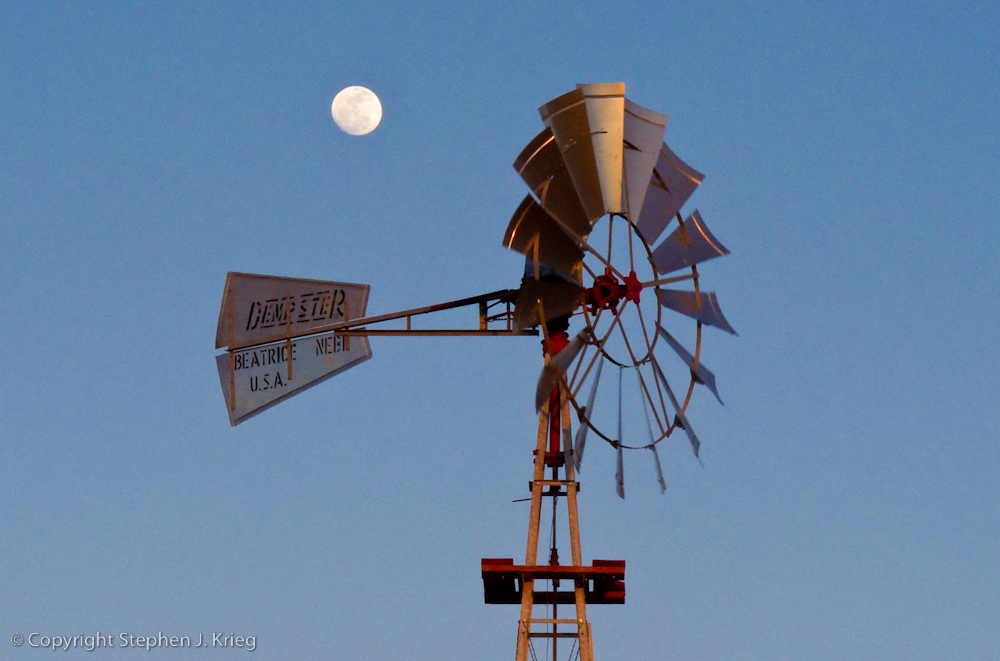
[Photo: Windmill and nearly full moon at sunset, State Route 97]
Leaving Highway 93 north onto State Route 97, I stopped just before the sun dipped behind the western mountains to pair the moon with a windmill pumping water into a water tank for cattle. 


[Photo: Dusk at the Santa Maria River]
Driving east in the dusk on S.R. 96, I crossed the Santa Maria River for the last photo of the day. After driving across the bridge, I parked so I could walk onto the bridge for my intended shot. A heron in silhouette flew south along the river toward wherever its roosting place was for the night.

Finally, it was more desert and canyon driving in the dark, then up over the mountains through the Prescott National Forest via Skull Valley, and back down into Prescott.

So my little drive had turned into a ten hour, 180 mile foray; not unusual for me. Have Camera, Will Travel.

-------------------------

* That must make Flagstaff, 90 miles to the north and about 2,000 feet higher in elevation, Arizona's "Heck of a Lot Higher Than Prescott" City.

(Click on any photo to see a larger version.)

Locations: Yavapai County, central Arizona.

Tuesday, February 19, 2013

Mountain Winter Water, Quehanna


A clear, pure, rushing mountain stream in northern Pennsylvania in winter. Steep forested hillsides all around. Solitude. Excitement and reverence.

I walked up along the stream, around mossy boulders and through wild Rhododendron and Mountain Laurel bushes. 

In this photograph, the tiny waterfall is flowing diagonally across the composition. The spray from the water has frozen on the edges of the rocks as the stream lowers in volume.

Location: Quehanna Wild Area, Elk State Forest, Elk and Cameron Counties, northern Pennsylvania.

You might also enjoy my Grand Canyon Photography Blog [click here].

© Copyright Stephen J. Krieg

Saturday, February 16, 2013

Winter Falls, Quehanna Wild Area


Small waterfalls are some of the most beautiful. You can get close to them without getting sprayed, without risking your camera equipment. As long as you don't fall in the stream getting your camera and tripod into position, that is. 

In this photo, a long shutter speed allows the water to blur enough to give the feeling of it flowing and bouncing down the rock layers.

At an unnamed brook in the Quehanna Wild Area, Elk State Forest, Pennsylvania.

© Copyright Stephen J. Krieg